Our Pembroke trip was one of those spontaneous “it’s too nice to be at home, where shall we go” efforts, so it was a happy surprise when I realised that our first day in South Pembroke would coincide with one of the Range West briefings. Regular readers might recall that we visited Range West as part of a Covid silver-lining when the MoD made special arrangements to conduct the briefings online.
Sadly, owing to some selfish behaviour, this excellent scheme was withdrawn (apparently some idiots were even actually bivvying on Range West – a LIVE FIRING RANGE! – can you believe it?) and the system of face-to-face briefings reinstated. There are only half a dozen a year, so we got lucky!
https://www.thebmc.co.uk/range-west-briefings-2023
Jim made it down from The Peak in time to join us and a couple of dozen fellow climbers who rocked up at the Castlemartin guardhouse at the appointed hour (6pm Thursday). The Army Major and Park Ranger who hosted us did their best to pass on dos and don’ts to protect ourselves and the wildlife. All delivered in 30mins in a friendly, informal style, but with the clear message that there’s stuff out there that can kill you!

Another unplanned bonus was that Friday through to the end of Monday were designated as maintenance days, so no firing (normally they only stop for the weekend outside the school holidays) so we duly presented ourselves the following morning to collect our passes and “Go West!”

Our previous visit “behind the wire” had been a great adventure but a bit mixed from a climbing perspective – massive seas, dodgy weather and unhelpful tides had all conspired to somewhat limit available dry rock. This time, all the stars were in alignment and the Range was our oyster! We headed to Juggy Point (having missed out previously due to waves breaking OVER it!)
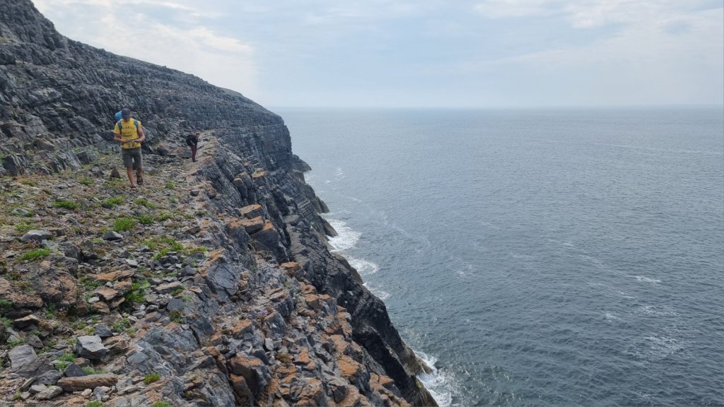
Easily recognisable and a straightforward short ab gives access to a bunch of routes at low to mid tide. Bucket Wall, VS, and Jug City, HVS, were indeed Juggy (just as well in the latter case as it’s really quite steep!)

Juggy Point Slab, Severe, offers a contrast up a smooth groove.
Heading back eastwards, we set up an ab down The Pedestal in Mount Sion East. Shell, HVS, belies its no-star status (well worth one or even two *, and pretty steady at the grade).
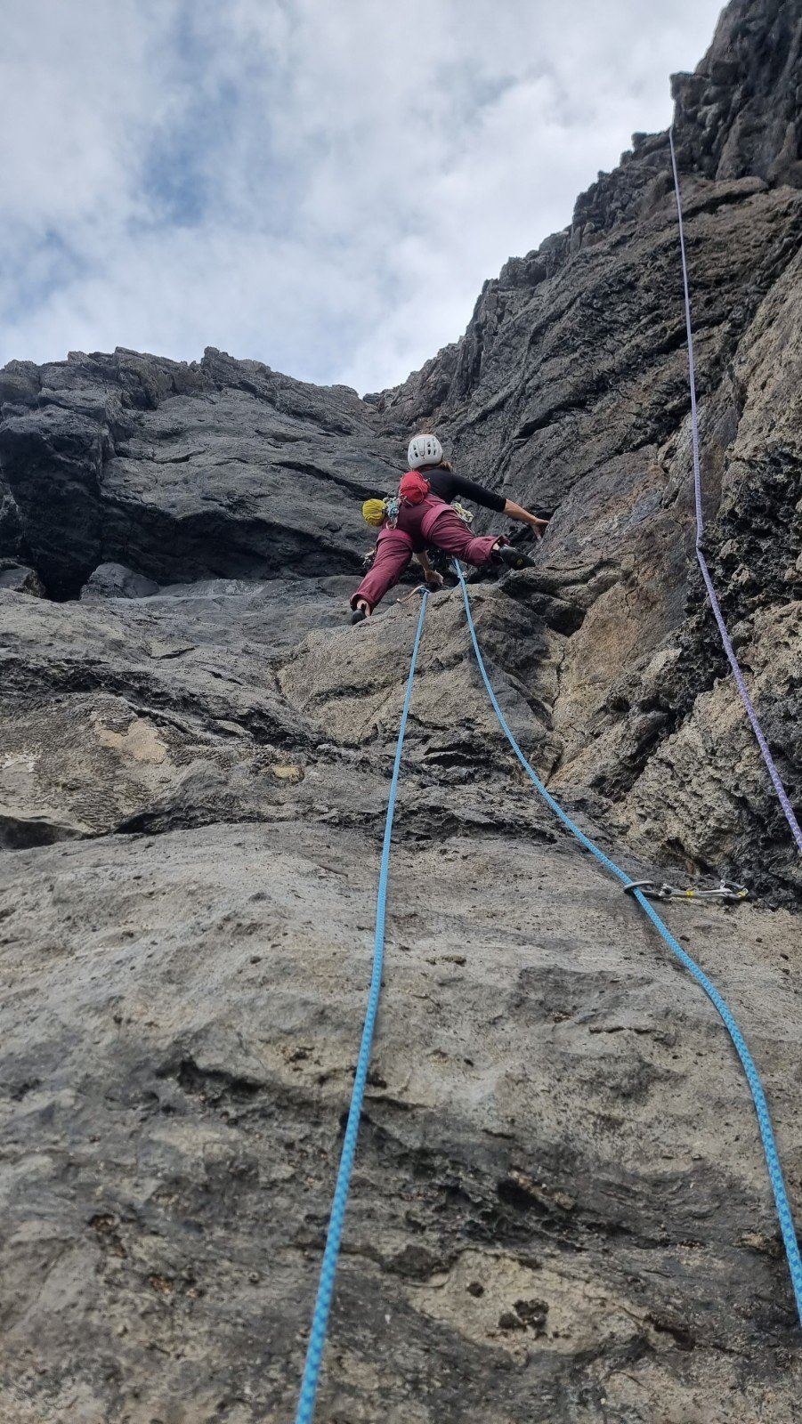
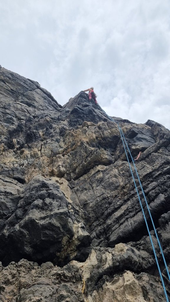
The same could be said for King Prawn, E1 5b, taking a cunning, sinuous line around overhangs – sustained but never desperate. Here’s Jim and me gearing up beneath it.

We also got a peek at some routes to come back for on Tidal Ledge (you guessed it – they’re quite tidal) and Abseil Hole (bird banned) which involve speleological explorations into the cliff.
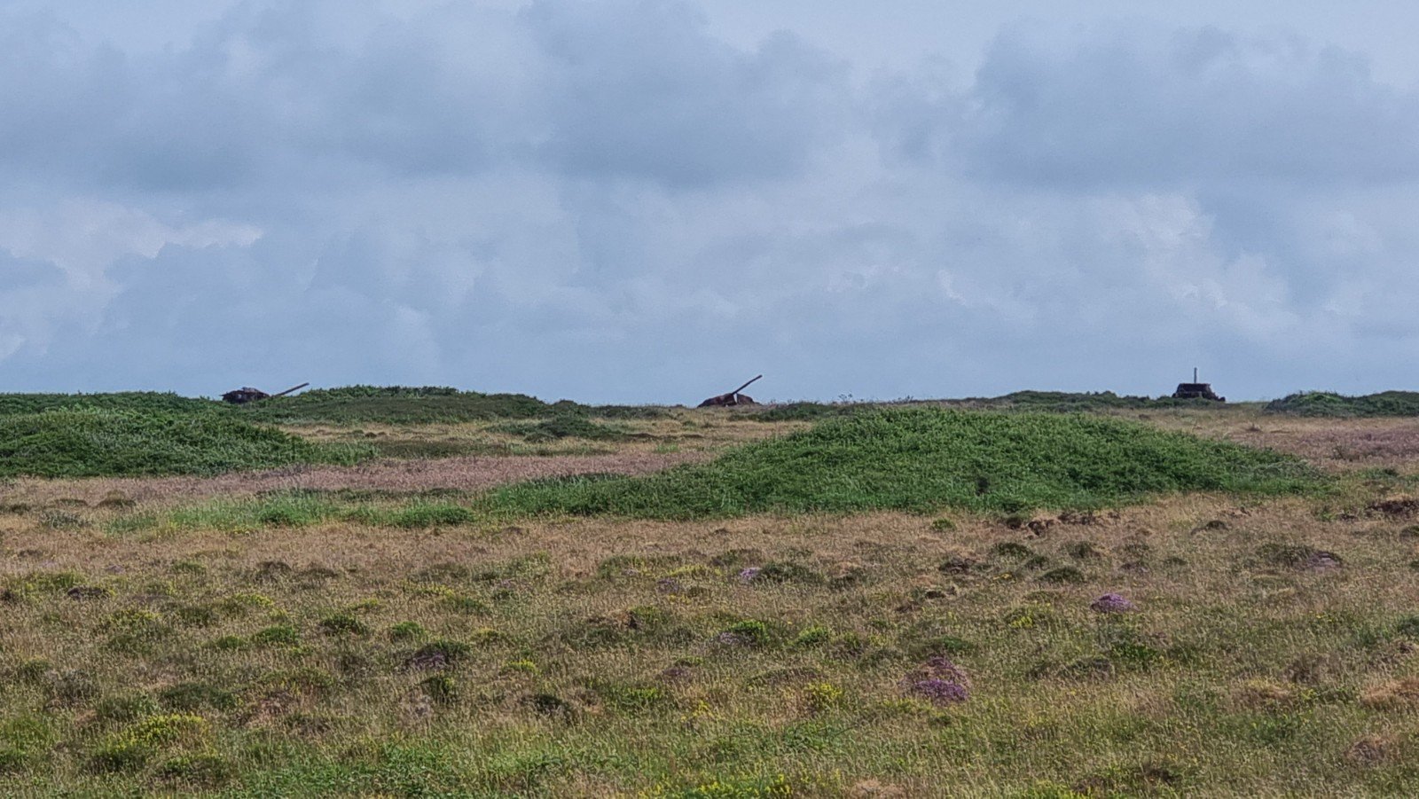
Plenty of wildlife in evidence, no doubt enjoying the peace and quiet afforded by the firing restrictions (in between bouts of actual firing of course!)


Whilst Range West was open on Saturday, the Green Bridge parking had been taken over by the start of an ultra marathon, so we headed over to Crickmail Point. Much of this is bird banned, but the east face is OK to climb on, and also a poster at the clifftop indicated that restrictions had been lifted early on parts of the south face (always worth keeping an eye out for these as the Park Rangers are quite proactive in adjusting restrictions in the light of events).

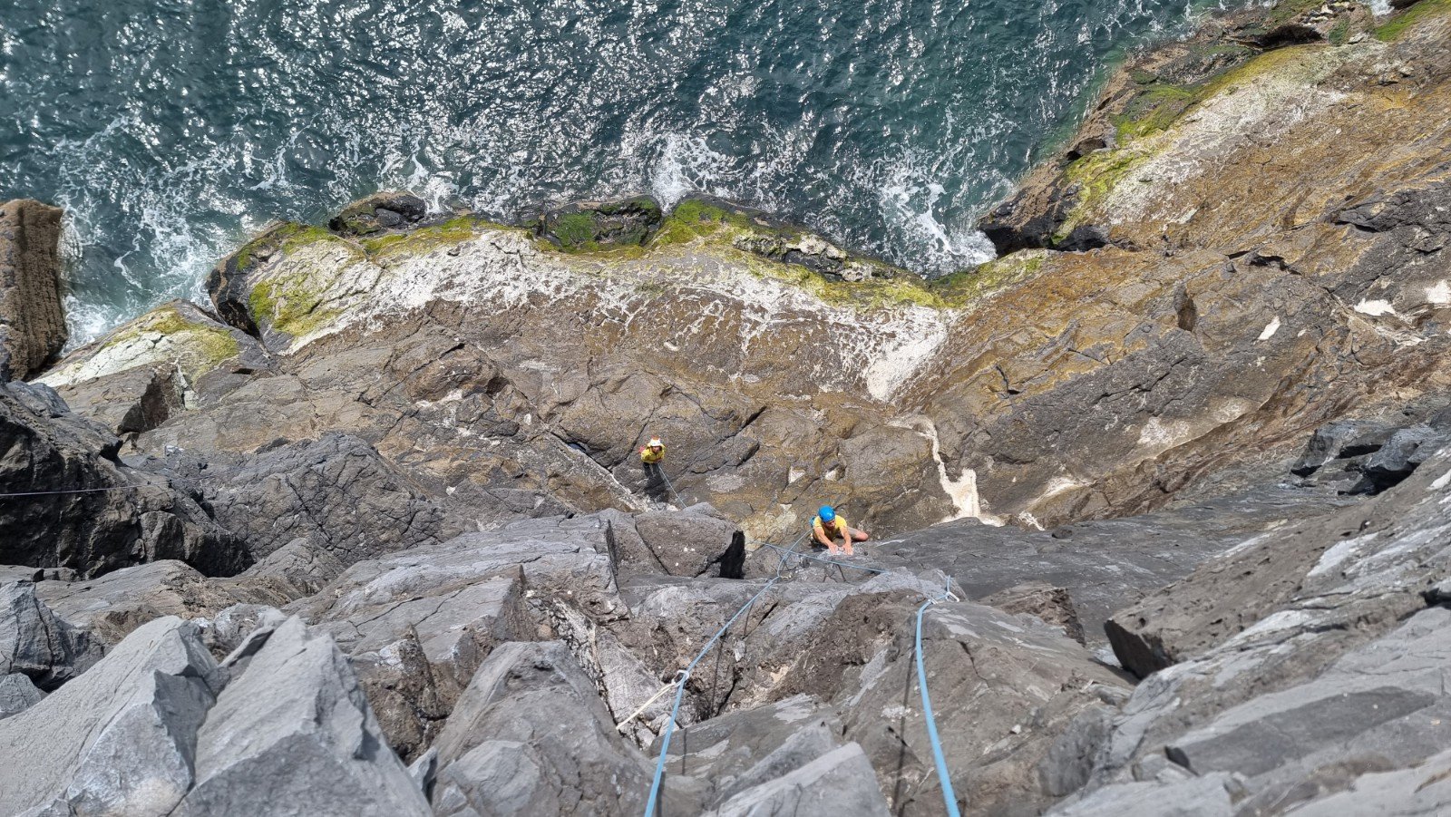
I combined the two pitches of D-Day Landings, E1 5b, 5a, with P1 being fairly straightforward and the second offering a bit of a struggle up an offwidth crack followed by a startling encounter with a gulls’s nest out of sight on a ledge about 10m from the top.

Round on the east face, Malice Aforethought, HVS, is a soaring natural line up an impressively steep wall, dropping clean into the briny. Great climbing though we were unlucky to sample it after overnight rain as stonking jugs and jams were all a bit gloopy.
Back out west on Sunday, we ventured onto Mount Sion West to sample some of the routes on the Bulliber sector. Easily access via a scramble, these shorter lines offer convenient if less spectacular fare. We did Operation Pedestal, VD…

Whelkhome, VS and Blow Your Own Trumpet, S.
Fine views back to Mount Sion, bounded by Juggy Point on the skyline.

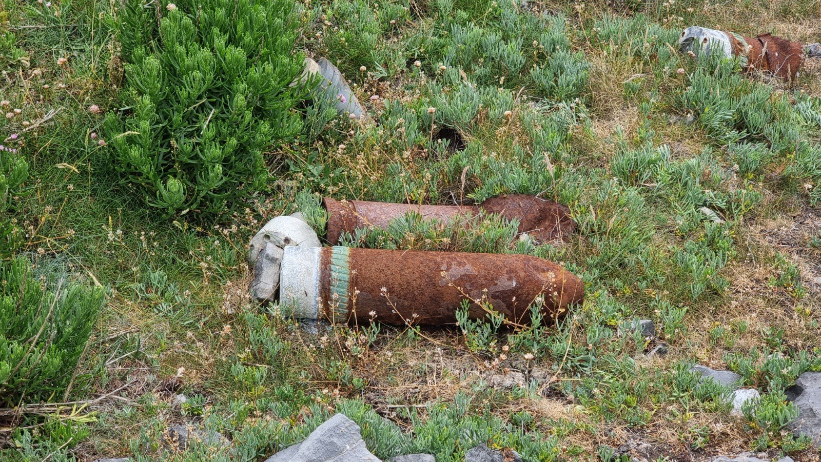
Never far from a reminder of the usual weekday usage!
On the opposite side of the dry valley, on the very lefthand end of Mount Sion West, a clutch of three one-star VSs occupy a largely non-tidal platform (though scrambling in does require a lower tide). Bobby Dazzler, VS 4b, takes an improbable line up an overhanging corner, approached from the left by some tricky moves on snappy rock.

The corner itself is super-juggy, though a bit friable and razor-sharp, as Helen found when a crumbling foothold resulted in some nasty cuts to her hands, and a few bumps and bruises.

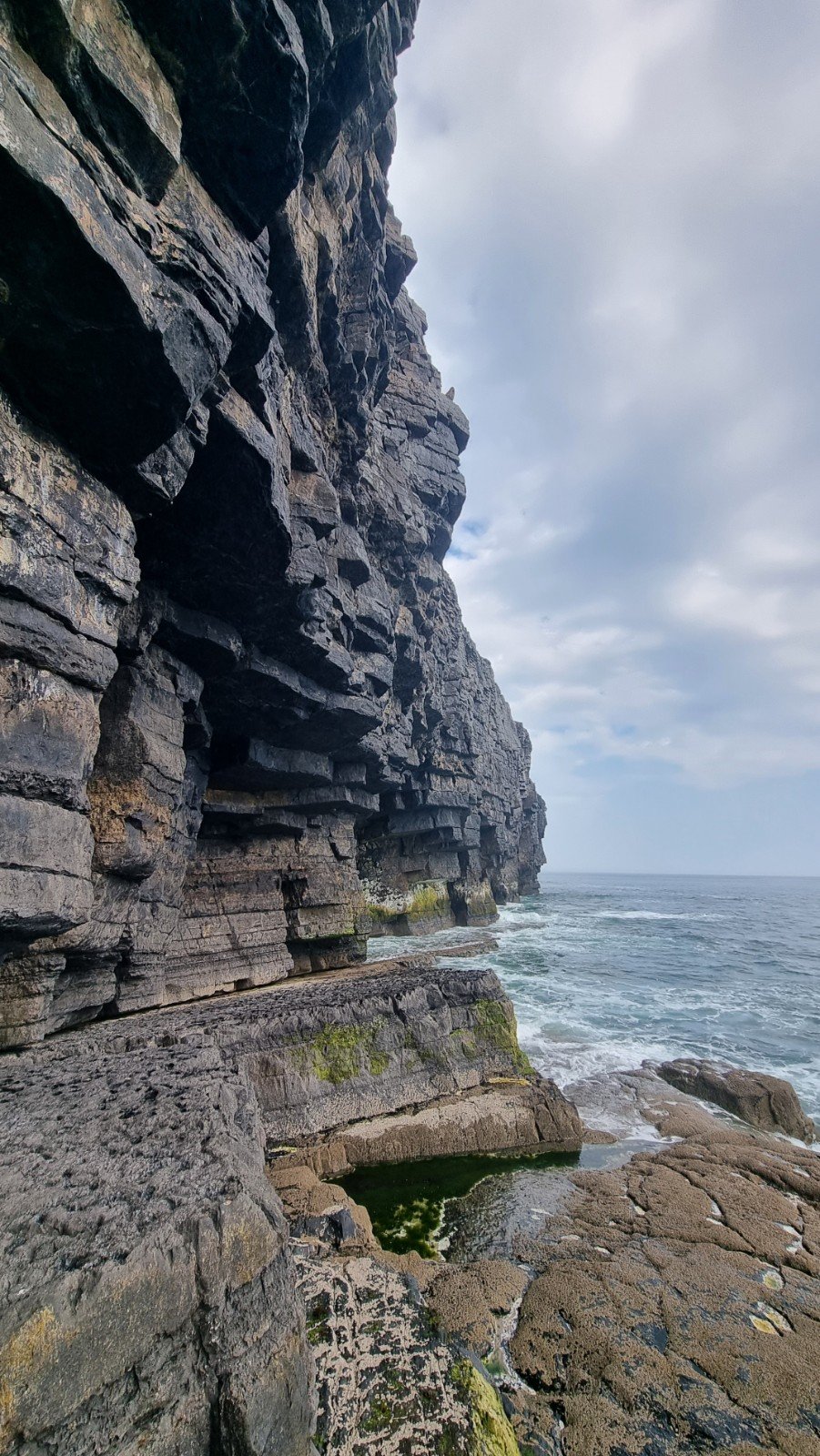
That brought an early close to proceedings for the day, followed by an unscheduled rest day. It seemed a shame to have a pass into the Range and glorious weather, so we picked up a key for the Gupton Gate which enables access to the far western end of the Range, and headed over for a recce. Full Tilt Wall is the primo venue in the vicinity, and it’s a 70mins walk, so well worth ironing out any wrinkles on the approach without a tonne of gear on your back.
I set out from the car park following the slightly vague instructions and sketch map in the Wired guide. This gives detailed coverage for finding the individual sectors but is a little ambiguous about how you get down to and across Frainslake Sands: “follow white stumpy posts” and a tiny map which shows these cutting across more or less diagonally to the far end of the beach. Trundling along a gravel track, I did see the occasional white wooden post (but there are all sorts of posts and markers out there!) and as the track turned to a sandy path, so the posts turned yellow and then I spotted a red one. I was only a hundred metres from the beach but discretion prevailed and I retraced my steps back to the van.
We’ve also got the definitive Range West guide (which pre-dates the Wired Guide), and digging into this it suggested following the track down towards the wireless station, before traversing the full length of the beach around the high tide mark. Sure enough, closer inspection revealed a much more continuous line of white wooden markers along the tarmac road for about 300m before cutting left over grassland to the dunes above the beach, where a marker post (and in situ rope) point the way to a steep sandy path down to the beach. Beyond that, things are a bit more obvious – here’s my best guess at the intended route (note the line along the length of the beach was around the high tide mark to avoid disturbing the nest of a pair of Ringed Plovers).
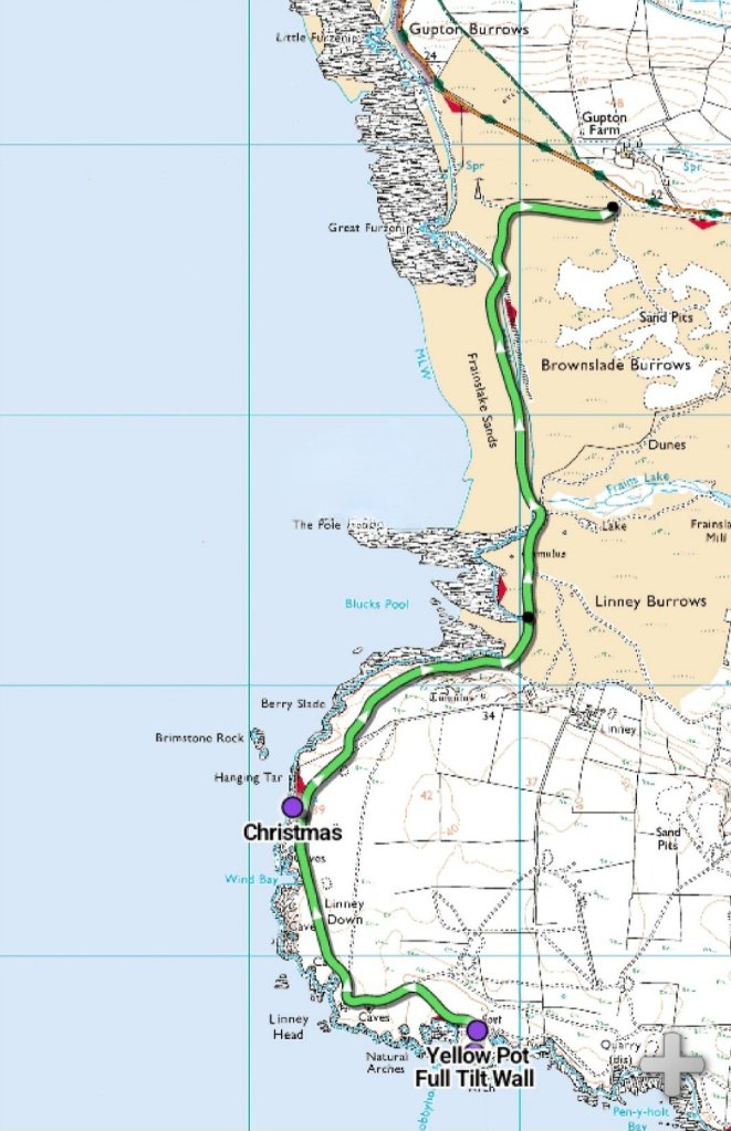
Not sure if my original route (more or less cutting directly down through dunes, from the parking area to the end of the top of the beach) is an alternative or not, but if it was a mistake then it was an easy one to make. Take care out there!
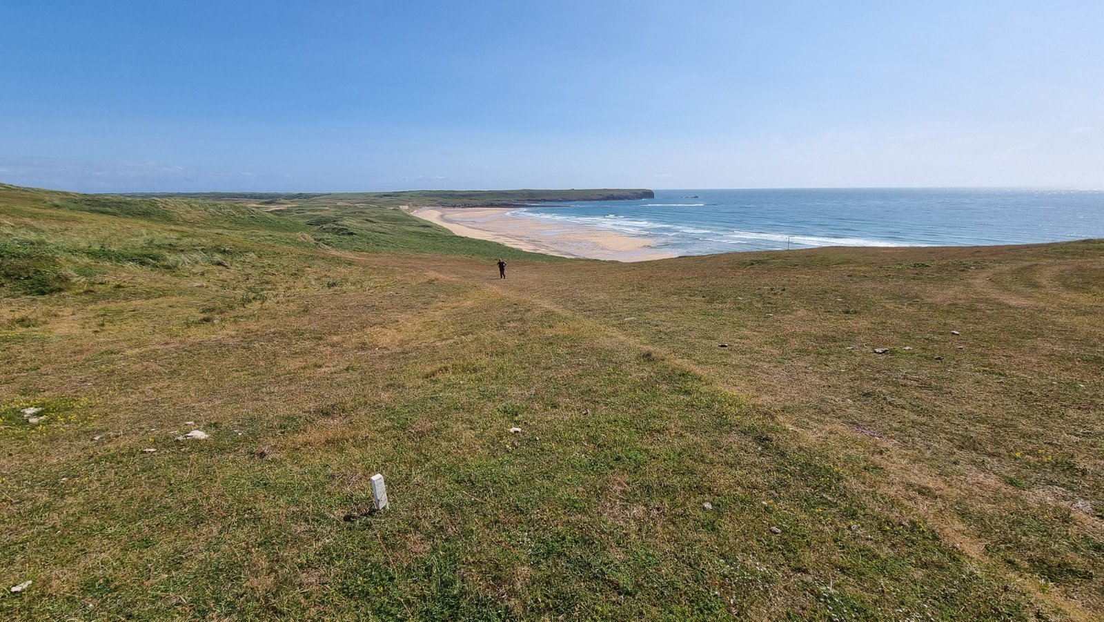
Here’s the view of a couple of the white posts as you head down to the beach…
… and one of the Plovers, who despite our best efforts to avoid them, seemed quite curious about us! (rest assured – it is taken at 100x magnification!)

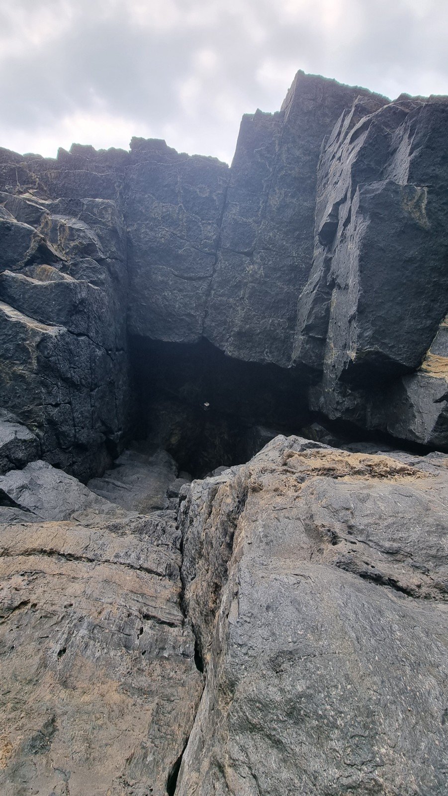
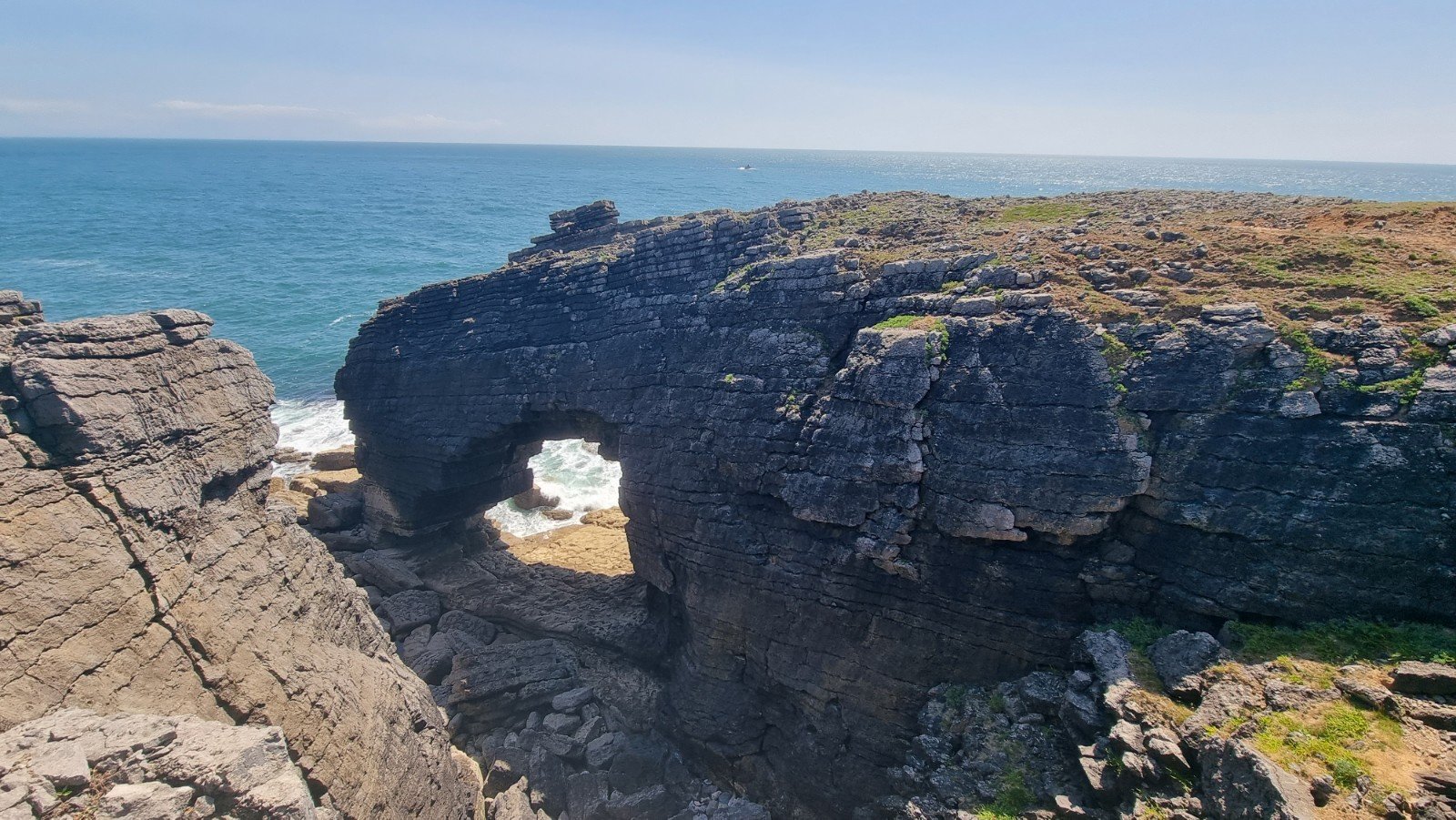
Once beyond Frainslake Sands and the smaller Buckspool Bay, more markers indicate the route skirting back to the clifftop and a military road that runs along it, which gives access to the various sectors. Full Tilt Wall is situated beneath the Iron Age Fort, and accessed easily but spectacularly through a natural arch:
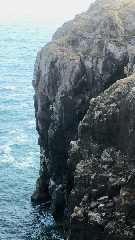
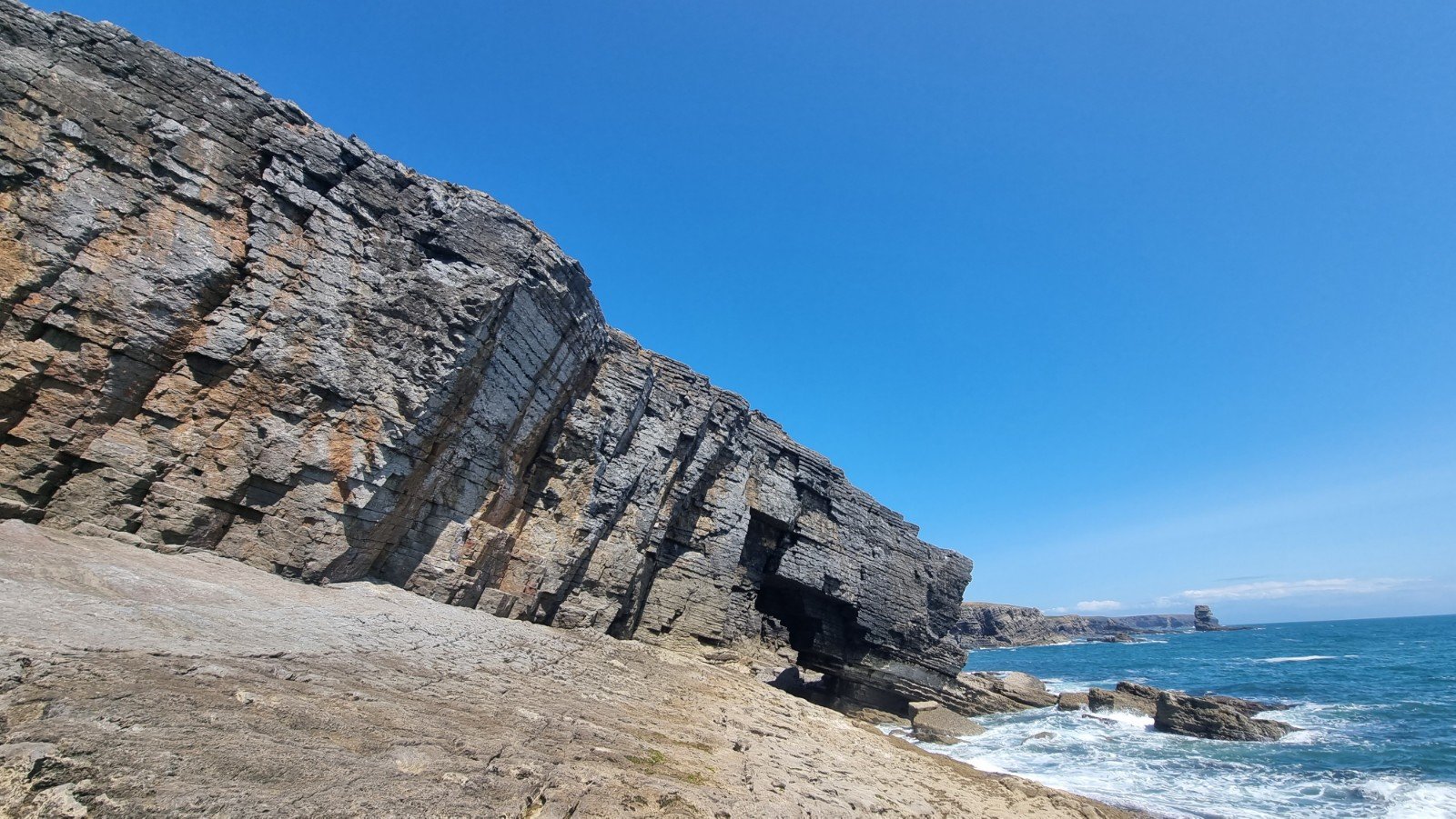
The wall definitely lives up to its name, and the routes look short but fierce:

On the way back, I took a quick look at Christmas Chasm Wall, part of the Western Walls, with a remarkable collection of very amenable routes (VDiffs and Severes) flanked by a few E1s and 2s, in a stunning location.

Plenty to come back for, now that we’ve sussed out the approach properly. You know what they say about time spent in reconnaissance!

Pingback: Wild West | RockAroundTheWorld·