After the sandbag trad and hot, grueling walk-ins of Tahquitz and Suicide, we were open to some lazy roadside sport – ideally at altitude and/or in the shade. Mountain Project threw up various options in the San Bernadino Mountains, with Lake Arrowhead and Big Bear Lake both sounding like good options to explore. Plans were thrown back into the melting pot when we discovered that the whole area was banned due to a wildfire (well done the “wildfire layer” on Google Maps!) resulting in a hasty rethink. We’d have to head into the Sierras to get any relief from the heat (still 40C+ around LA) but that meant a decision point – West into the Sequoia / King’s Canyon NP or East towards Bishop and the Eastern Sierra. On a coin toss we turned right.
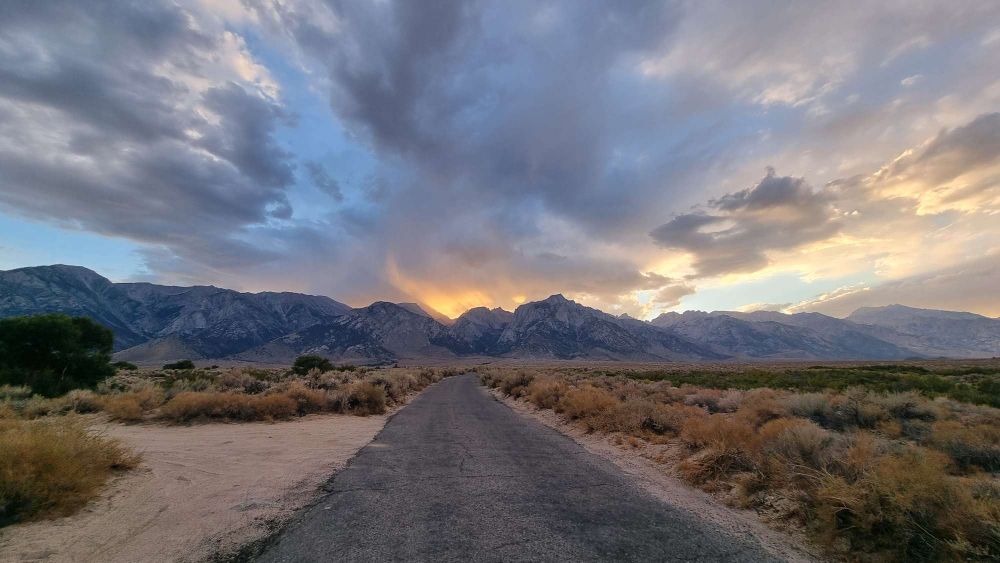
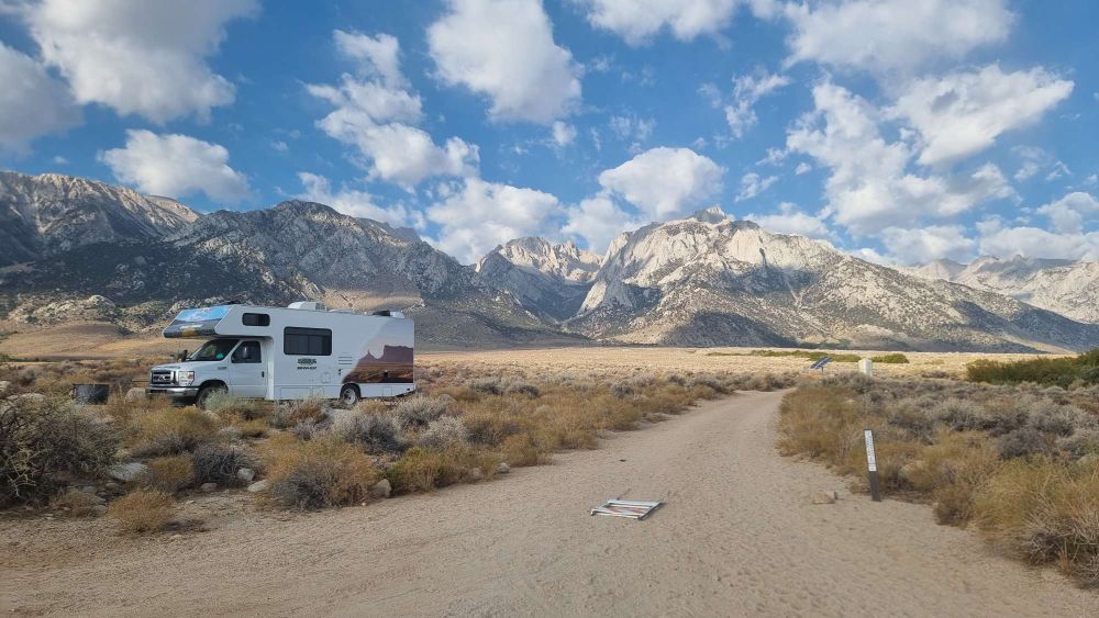
Five hours later we were pulling into the Tuttle Creek Campground ($10/night BLM bargain!) near Lone Pine, in the Alabama Hills, on the slopes of Mount Whitney, just in time for a spectacular, moody sunset.

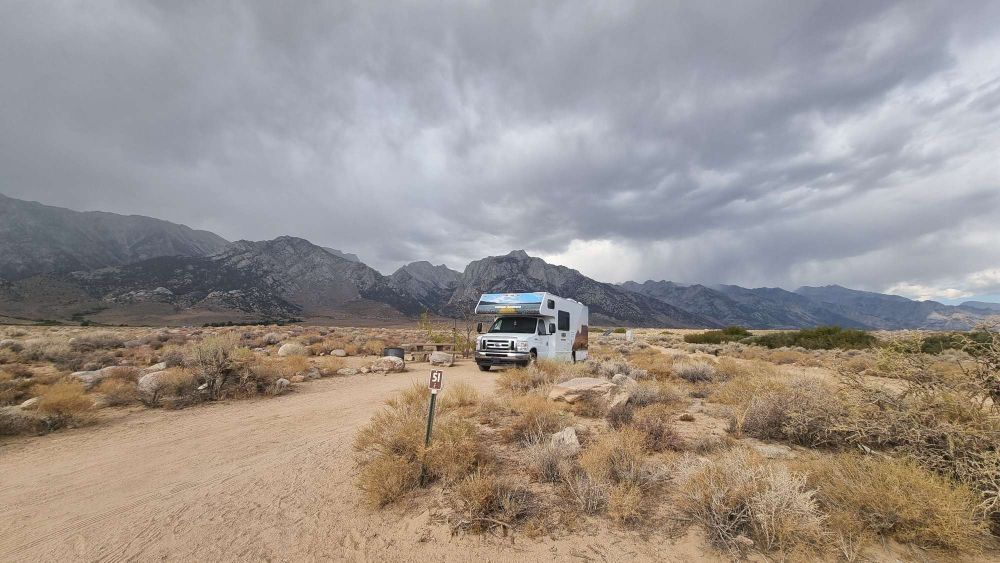
Next morning it’s fresher but still pretty warm in the sun despite being at 5,000ft. Not a bad spot for a campsite.
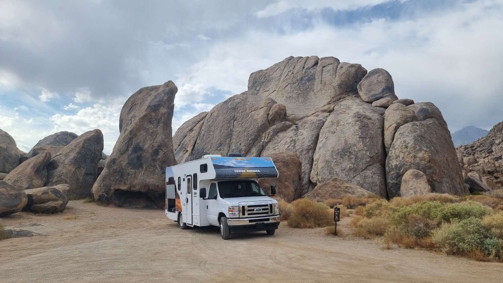
The Alabama Hills are reminiscent of the much more famous Joshua Tree, strewn with granite lumps – boulders, domes, fins and pinnacles, with well over 500 easily accessible routes established – many of them belay-from-the-bumper friendly. It’s been termed “the ultimate lazy man’s crag” – just what the doctor ordered!
We ticked most of the routes on the shady Paul’s Backyard…

… before strolling over for an ascent of Burnt Penis (don’t shoot the messenger!), a wild journey at 5.7!
A tad warm for sunny climbing in the early afternoon so we broke up the day with a wander around some of the more notable rock formations, including Mobius Arch

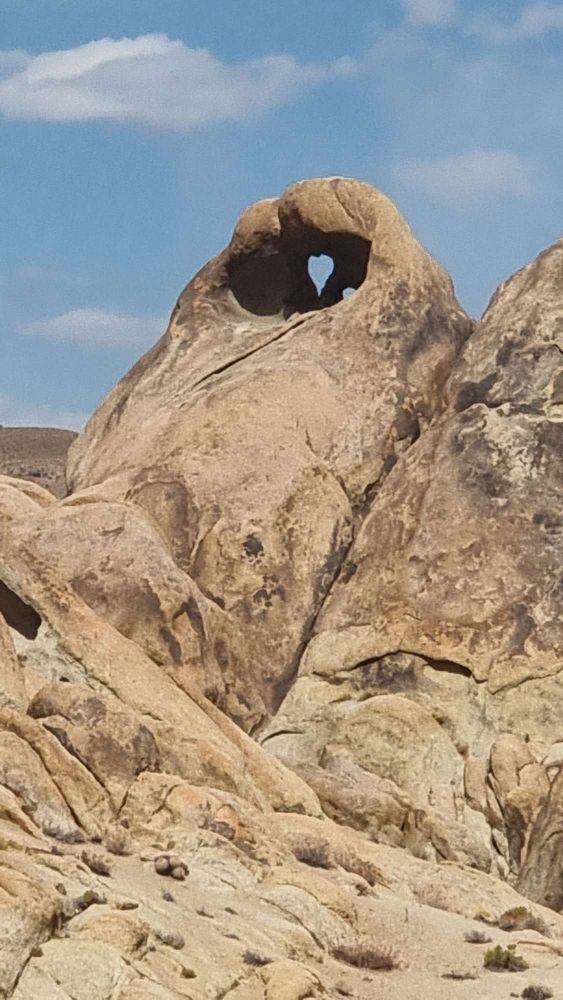
… and Heart Cave
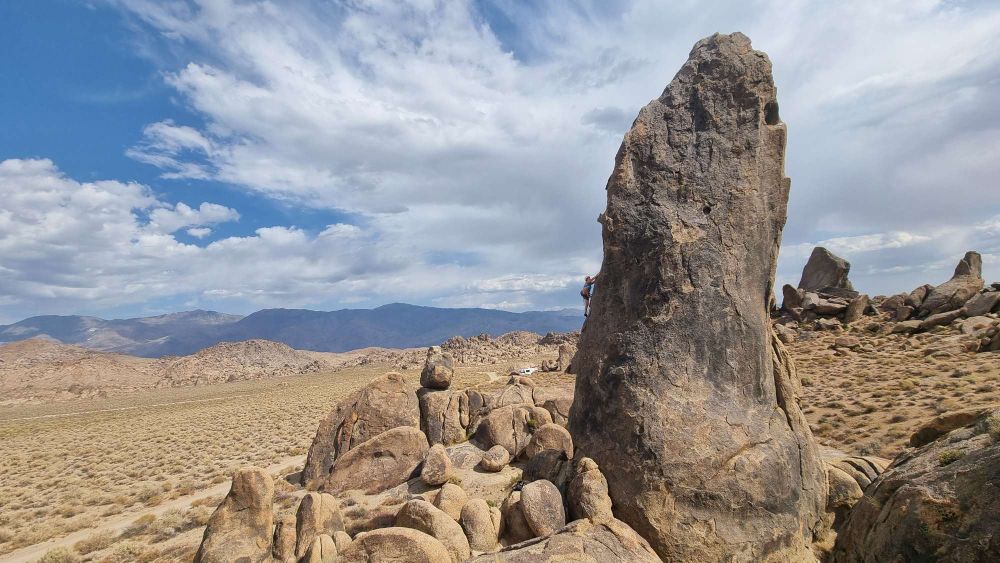
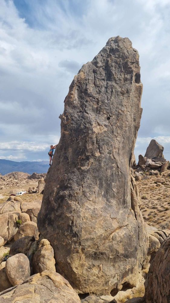
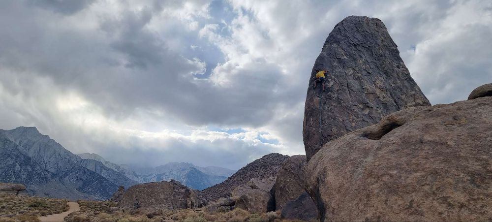
… by which time a bit of cloud cover and a breeze were making for better climbing connies. The Shark’s Fin is an impressive 70ft monolith…

… with the brilliant Shark’s Fin Arete making its improbable 5.7 way up the right hand side…
… and the equally aesthetic, but not such great climbing, Pirates on Horseback, 10b, up the left.
A 15mins drive winds you up to the Whitney Portal, around 2,500m, departure point for the ascent of the highest point in the southern 49 states. A strict permit system, issued in a ballot six months in advance, avoided any temptation to head up for some peak-bagging.
Brighter the following morning…
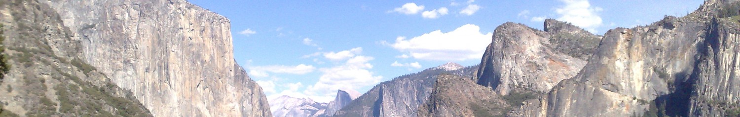
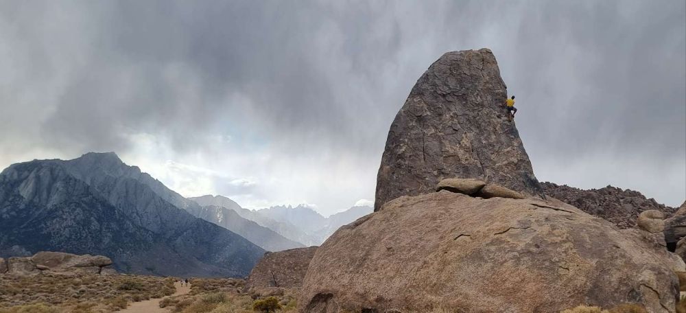
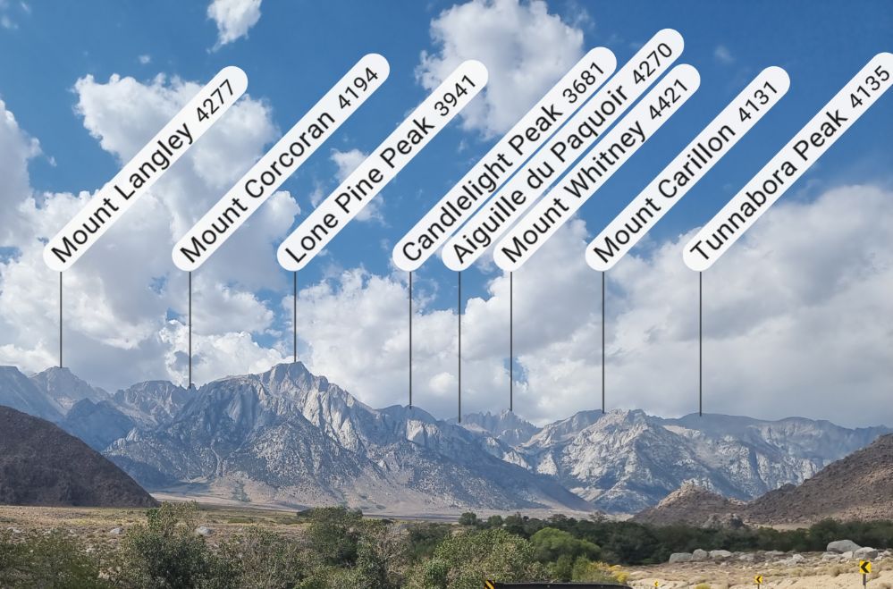
… and the whole of the Eastern Sierra is on immaculate display.
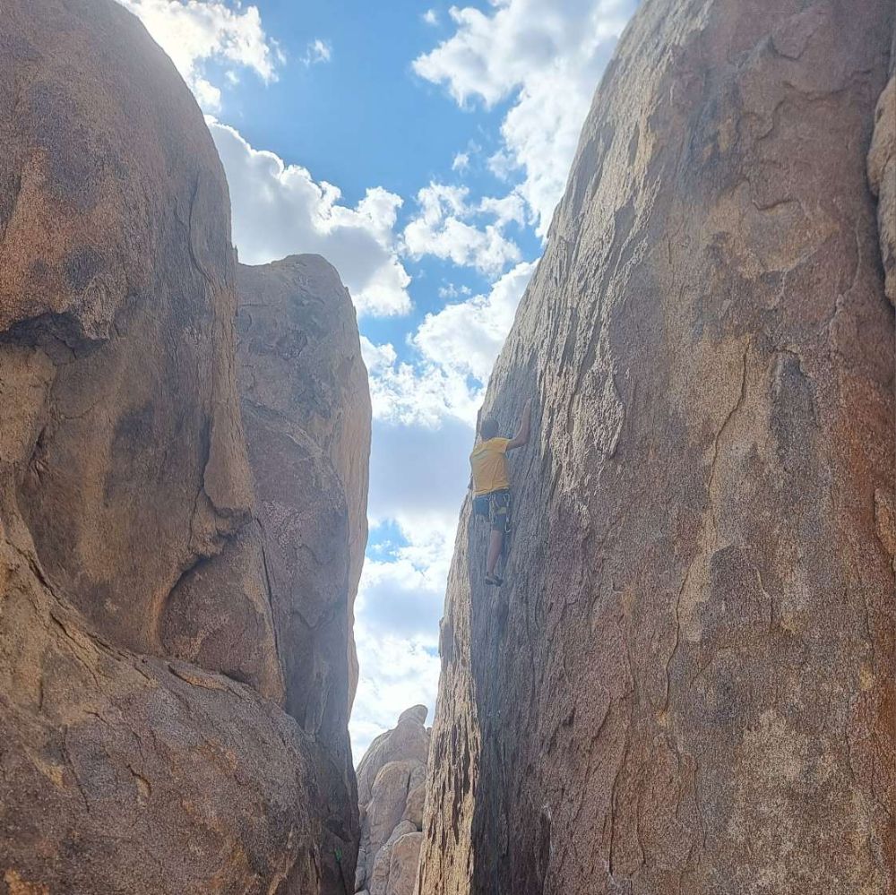
More shady options required, and The Corridors are just the job – a series of North-South oriented blades of granite providing shade-or-sun choices. Imagine Lower Sharpnose made of granite and you’ll have absolutely no concept of what’s on offer – better to check out this photo:

Helen was on a rest-day / belay-bunny mission, so I worked my way across the Gettin’ Western Corridor routes, finishing with Saddle Sore, 11a, just as the sun hit.
Time to call it a day, and also to move on. It’s fun, convenience climbing, in a magnificent setting, but the actual movement is a bit samey – the routes rely on exfoliation edges and somewhat bendy flakes, and it’s crimp, step, pull, repeat all the way. Having said that, I suppose that’s true of much climbing – what a commendably pointless activity :-)…
