Heading south from Banja Luka, we took a route via Sarajevo, where there’s a lot of climbing and a dedicated chunk in the guidebook. Closer investigation reveals it’s either quite urban or set at a high altitude in the surrounding hills. We’re en route to Kosovo to participate in the UIAA General Assembly taking place at Peja, so unusually for us we’ve got a fixed time and place on the schedule. With a dull day, chilly temps, and a tight timetable, we decided to press on southwards and potentially loop back to explore if/when there’s a weather window.
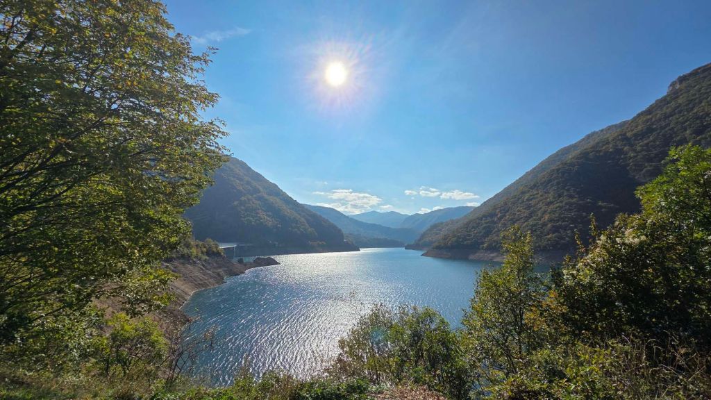
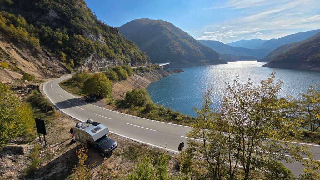
Heading out of Bosnia towards the Montenegro border, the road deteriorated to pot-holed switchbacks for the last few miles, skirting the Drina river, though judging by the number of swanky new rafting camps dotted along the road, it’ll probably get tidied up soon. Border formalities were straightforward and we crossed a rickety wood-boarded bridge into the next stage of the adventure. The road improves considerably and we were driving through a series of tunnels carved halfway up the side of the impressive Piva gorge. This is dammed at the end and we popped out of the end of the gorge at Piva Lake and some drive-by cragging we’d spotted on the web.
There’s no printed guide for Montenegro but it is well covered in 27crags.com. There’s also a dedicated website at https://topo.climbers-heaven.me/#climbing-in-Montenegro and even better a free app version here: https://play.google.com/store/apps/details?id=com.ilija97.montenegroclimbing
The Piva climbing is very handy – zero minutes off the route through to southern Montenegro and the best crossing into Kosovo, and with routes 50 metres from the car.
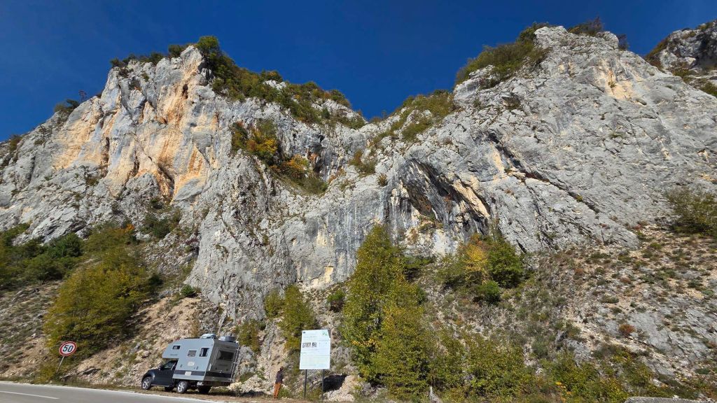
It’s one of these EU funded projects – a great amenity, but like a few of these initiatives, you do wonder who they paid to do the job. There’s a handy topo at the base, but no route numbers on it. There are route numbers on some of the lines, but most are too faded to read. And whilst the routes are very near the road, there’s no defined path up through the scree. With a bit more effort and thought it could be a lot more user friendly!
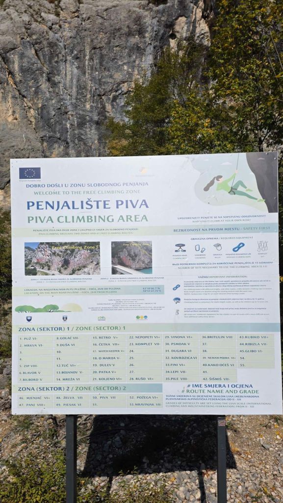
Here’s a few of the route numbers to give you a rough head start.

No complaints about the situation though!
We did routes 31 to 33, a couple of 6as and a 6a+. The climbing was much more our favoured style (crimps on rough rock rather than smeary slabs) and the grades were more reasonable than most of what we’d experienced in Bosnia, but the quality of rock left a lot to be desired. A bit more effort cleaning would pay dividends, as at least on the routes we did the loose rock was reminiscent of some of the shoddier Peak quarries!
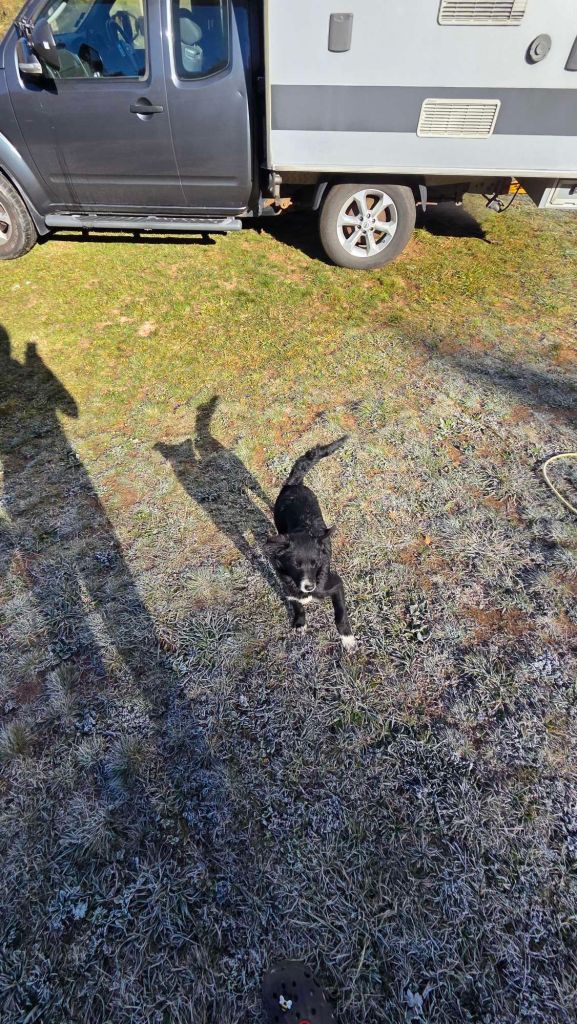
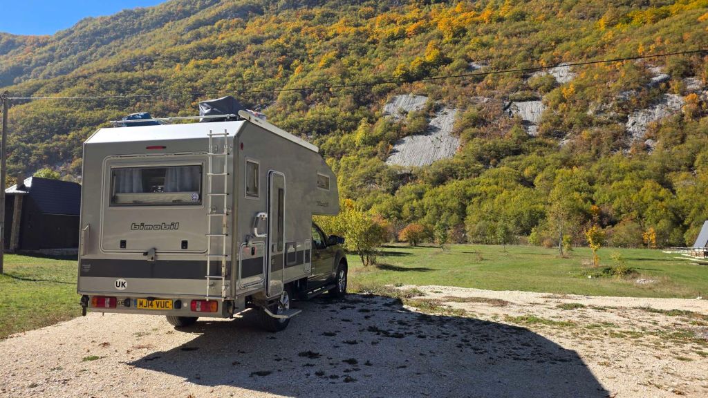
The main road continues south along the valley, but we’d been making for a “nearby” campsite. Nearby as crow flies, but accessed through more side tunnels and hairpins, gaining a fair bit of height in the process. Beautiful tranquility and simplicity at CAMPING ZELENI GAJ (GREEN FOREST), with a warm welcome to match. Our host was easily old enough to be my mum, but wielded her smartphone and Google translate to regail us with an explanation of how the waggy-tailed puppy “came with some cyclists and stays – ignore him if he is boring”. Frosty overnight…

… and playtime for the puppy.
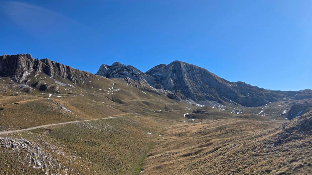
We were so charmed by the surroundings that we changed our plan for another session at the lakeside crags, and instead decided to make a detour through the Durmitor National Park. This is Montenegro’s largest protected area and a UNESCO World Heritage site. According to UNESCO it’s a stunning limestone massif in the Dinaric Alps or Dinarides, which constitutes the heart of a landscape shaped by glaciers, numerous rivers and underground streams embedded in the much larger Tara River Basin Biosphere Reserve. Some fifty peaks higher than 2,000 metres above sea level rise above plateaus, alpine meadows and forests, including Bobotov Peak at 2,525m.

The scenery is genuinely magnificent…
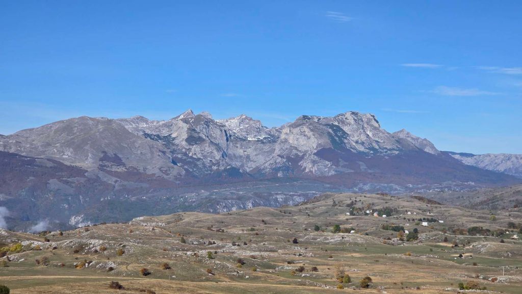
… with some extraordinary limestone geology…

The Durmitor loop is something of a “tourist to-do” item, and there are a couple of these “you in the frame” constructions.

We were also slightly taken aback to be asked for a €5 entry fee, from a slightly random bloke issuing tickets by the wayside. The tickets looked quite elaborate, so we coughed up – either in compliance or to celebrate the chutzpa of a slickly executed scam. Later web research confirmed the fee as genuine – you can even pre-pay online.
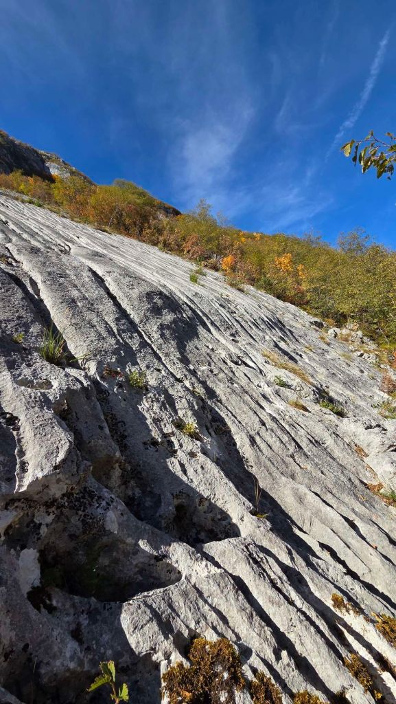
We traversed the Durmitor Park via the southern half of the loop before continuing our journey south via a side trip into the Komarnica Valley to visit another drive-by crag – this one we stumbled across via Mountain Project.
https://www.mountainproject.com/area/201141691/sector-inchworm?
Sector Inchworm is a 45° east facing, water grooved slab. It is a super user friendly beginner climbing area, with the low angle, decent friction and occasional holes / holds making for climbing in the 4s.
Fun to break a journey but a bit monotonous. We did three routes (Centipede, Little Snake and Big Snake – the latter being two pitches / around 70m)

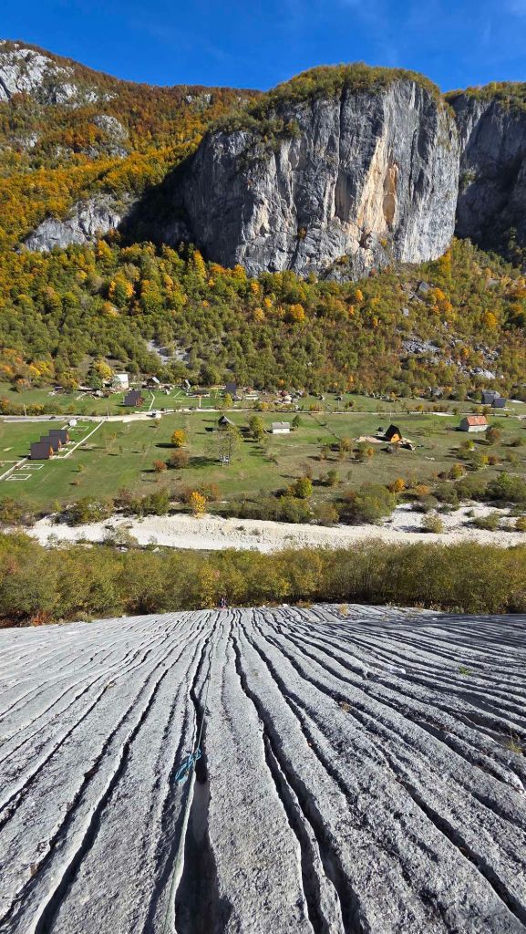
It’s an absolutely stunning valley, with endless climbing potential.

There are a couple of long multi-pitch routes on this major crag opposite (6-pitch 6c+ details on Mountain Project) with scope for hundreds more in the valley.

The sun left the crag (around 2pm) leaving a much chillier experience, given the altitude (probably quite welcome in summer). We also spotted a few bolts on some of the shorter crags leaving the valley which might be worth a future return investigation. Time to hit the road south.
