The twin towers of North and South Nassrani were the only major features not ascended by the Bedouin, before the arrival of European climbers. The North peak was finally climbed by the famed Austrian team of Albert Precht and Wolfgang Haupolter in 1990. These two have put up more routes than any other team in Wadi Rum and were renowned for a “no drilling” ethic: “the number of fixed pieces on a route must be counted on the fingers of one hand“.
The route in question was Hiker’s Road, and an original grade of D+ was soon upped to TD by subsequent ascentionists. It’s fair to say that this still underestimates the magnitude of the challenge – not so much in terms of technical difficulties but in terms of scale and complexity, especially of the descent. My trawl of Internet resources threw up very few ascents (7 UKC ticks compared to 133 for The Beauty for example). Casting the net wider, at least half of the reports I unearthed had featured a benightment. Nonetheless, Mr Petite had seen fit to include it in PdeL and raved about its quality, so the die was cast…
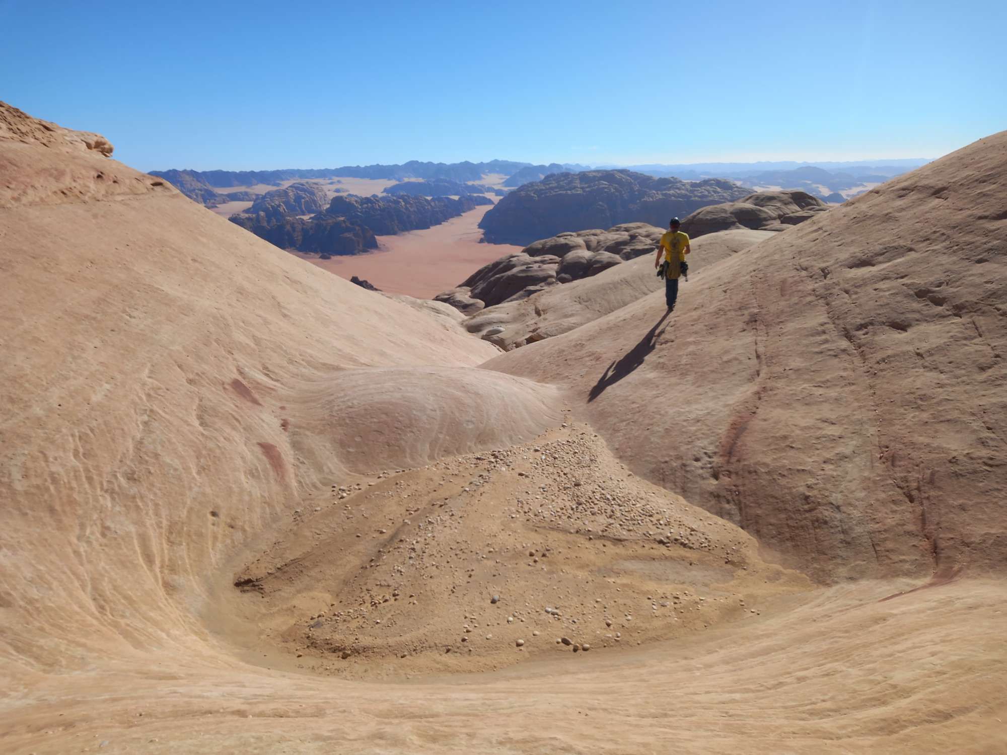
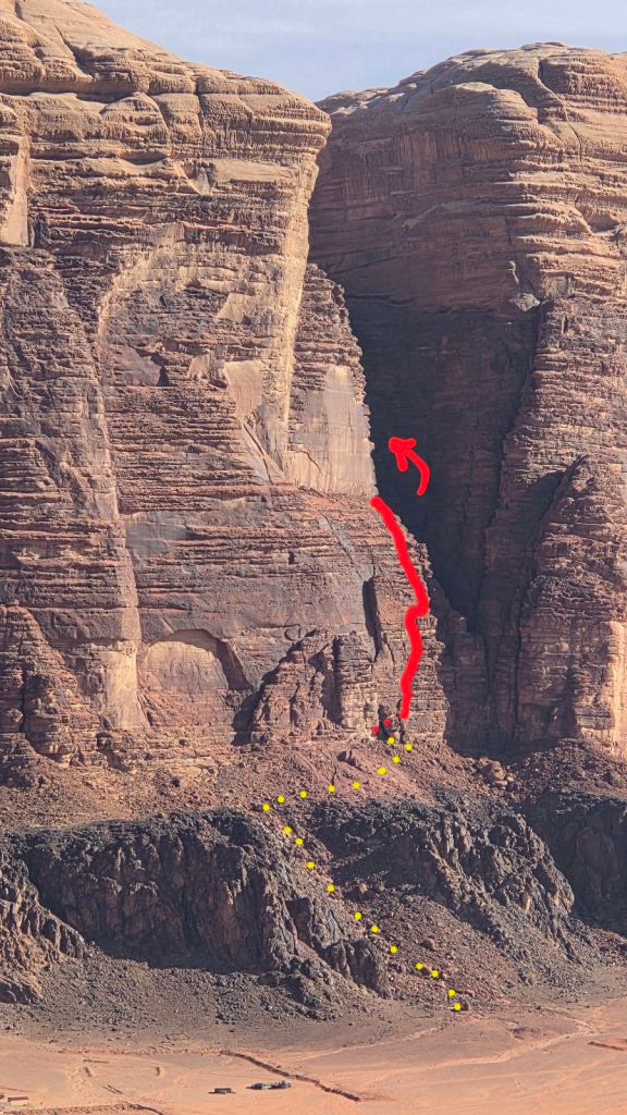
The approach is about 45mins and you could halve this if you get a taxi to the foot of the scree slopes beneath the crag (we didn’t). We got our day off to an unnecessarily exciting start by soloing up a slippery water-worn granite gully to the right of the route. Don’t do that!
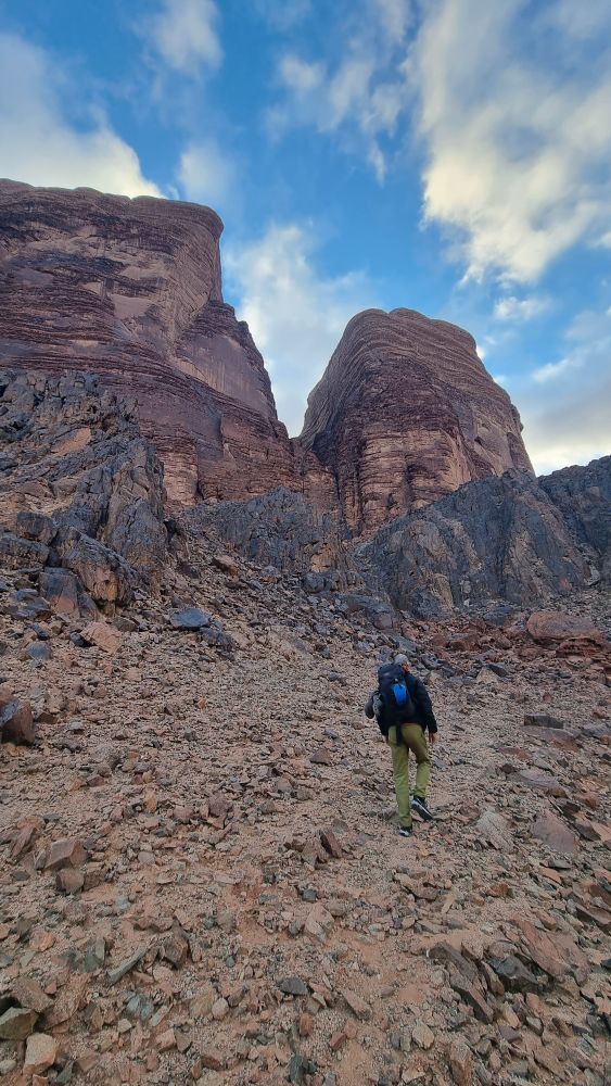
Instead, there’s a 20ft tall boulder with white painted inscriptions that serves as a convenient waypoint, and you can walk easily from here up an open scree gully heading for the huge arch feature on the wall.
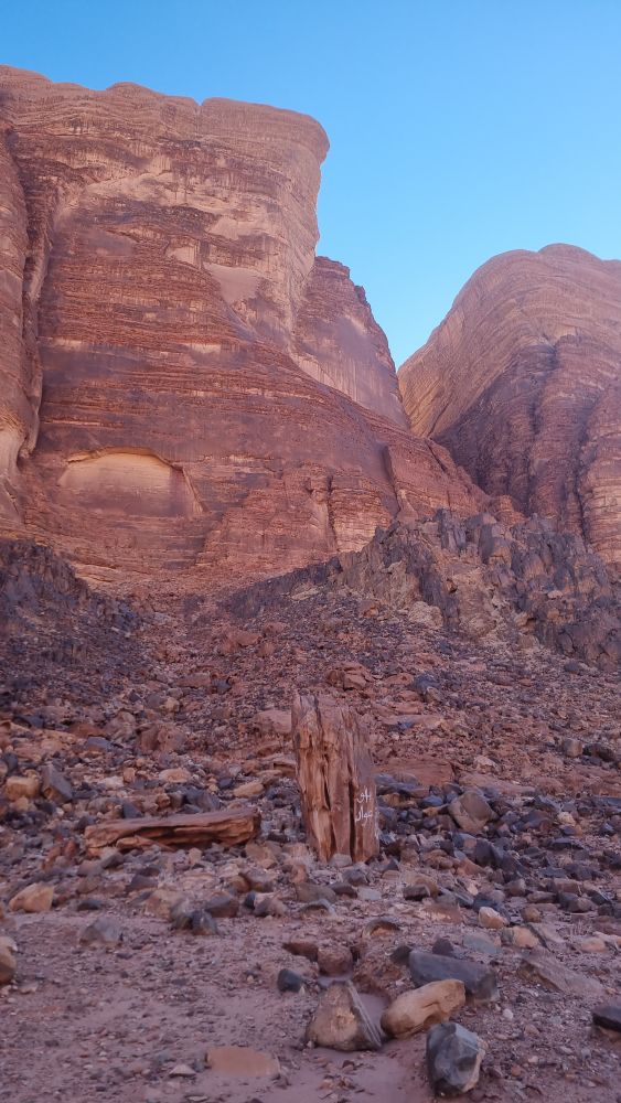
As the ground levels out, you skirt rightwards for about a hundred metres and the start is tucked behind a rock pillar, marked by a cairn.
29.562125° N 35.427612° E
You’ll find the topo from PdeL with a web search, and it’s worth supplementing this with the one from the Tony Howard guide (slight differences in the route) and this lovely colourful version from Vertical Pirate and then stirring in a dollop of good mountain judgement.
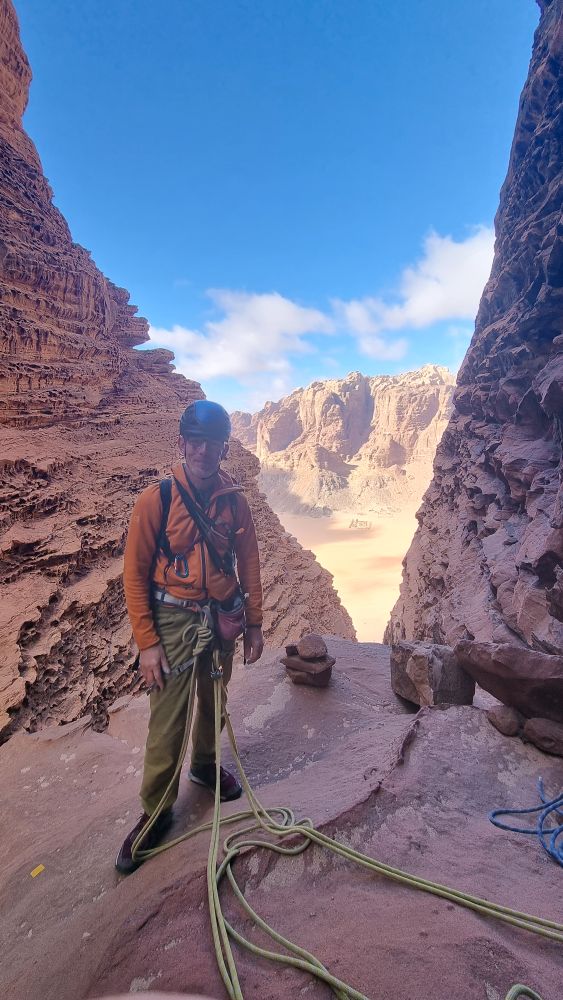
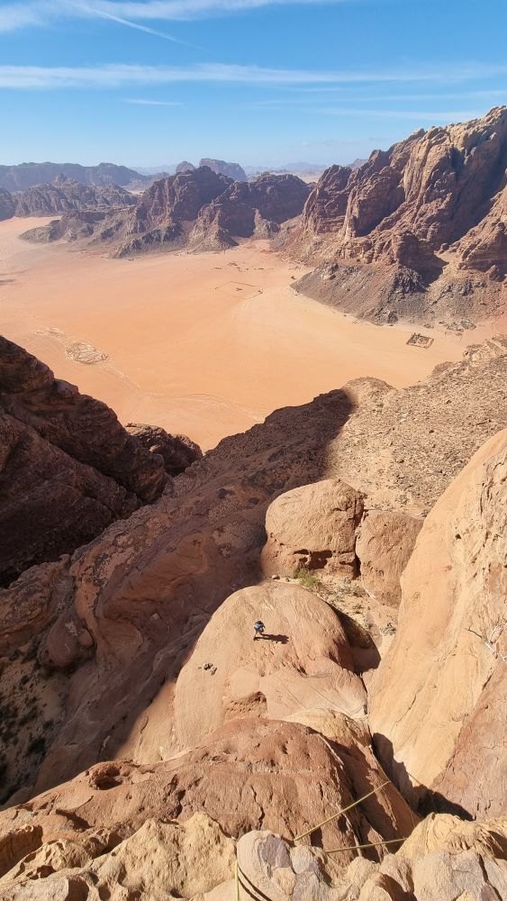
Hiker’s Road – Jebel Nassrani
We hatched a plan to move together for the most part, using one 60m rope doubled (so 30m apart) and carrying another 60m for the abseil descent, pausing to pitch at any tricky spots, regrouping to replenish gear every 100m / 3 or 4 pitches. This seemed to be pretty efficient. I’ve given a rough “block by block” description of where we went to supplement the topos (or add confusion – take your pick!)
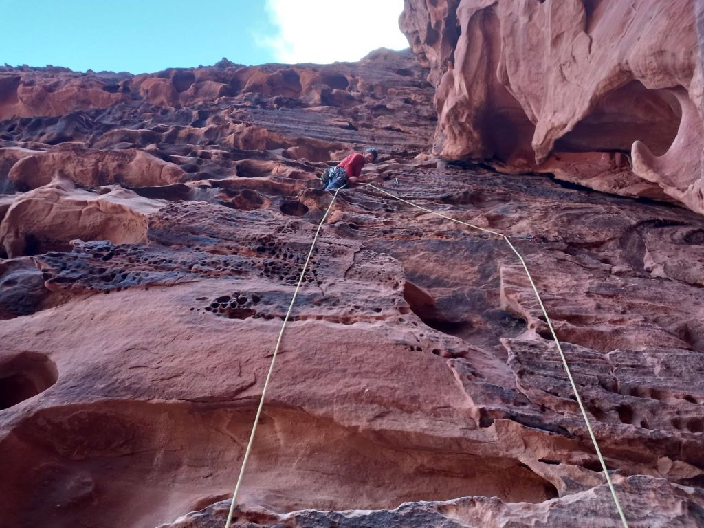
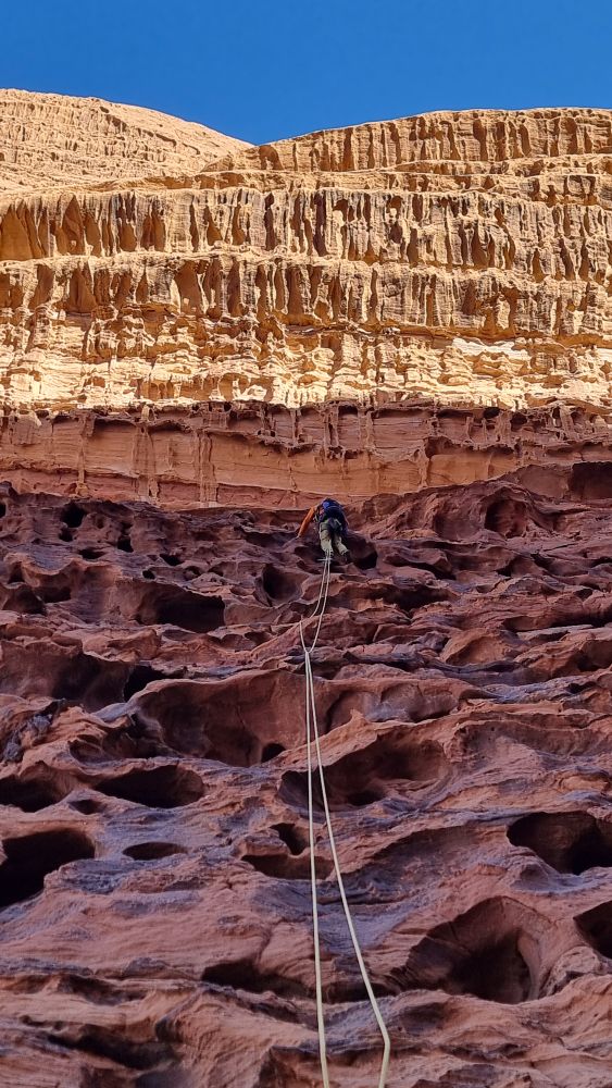
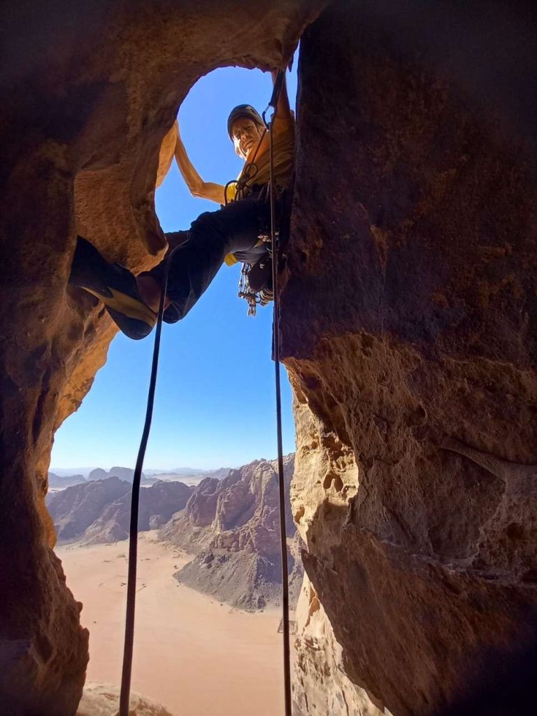
The route starts up a gentle ramp to an easy chimney, followed by a wild overhanging chimney with a bolt at its foot.
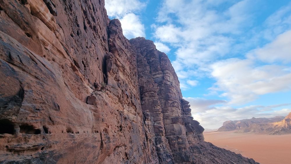
Up this (5c, a couple of cams in pockets give some protection) and up easier ground to the first rap point. (29.561946° N 35.427840° E) GPS is notoriously unreliable in the confines of a narrow canyon, but I’ve added a few waypoints which were recorded with +/- 10m accuracy – handy when trying to get down in the dark. To supplement this system, Andy came prepared with a few squares of reflective tape to mark key rap points, which proved to be a good combo. More later…
Onwards up a leaning rib/arete (staying out of the continuation chimney) until a step across the void allows entry to a vertical chimney in the wall (this might well be the “original” line – in hindsight the “modern” line might keep plugging rightwards at this point – TBH your guess is as good as mine). Follow this to a constriction (all a bit subterranean) and battle through this to a sloping shelf.
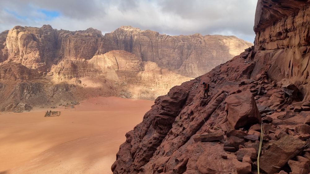
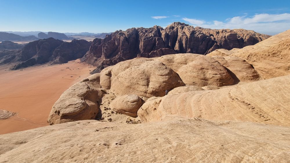
Above the shelf is a wall plastered with huge hueco pockets. I picked my way up this (mildly harrowing) before a traverse line at about 10m enabled progress rightwards and gained entry to a wide line of weakness, trending slightly leftwards and up for the best part of a hundred metres. Romping up this leads to a broad rock-strewn ledge at the base of a huge smooth wall (clearly visible from the ground). This huge feature isn’t mentioned in any of the topos, but I’d translated a French trip report which talked about “a ledge topped by a smooth 12b+ wall” – made no sense at the time, but in context it’s a perfect description. Here’s the report (translation attached for your edification and amusement)…
This goes on to mention skirting the foot of the smooth wall rightwards to a cairn on a ledge above a broad shoulder, from which continuing further right brings you to the second bolt on the route (about 200m from the first!).
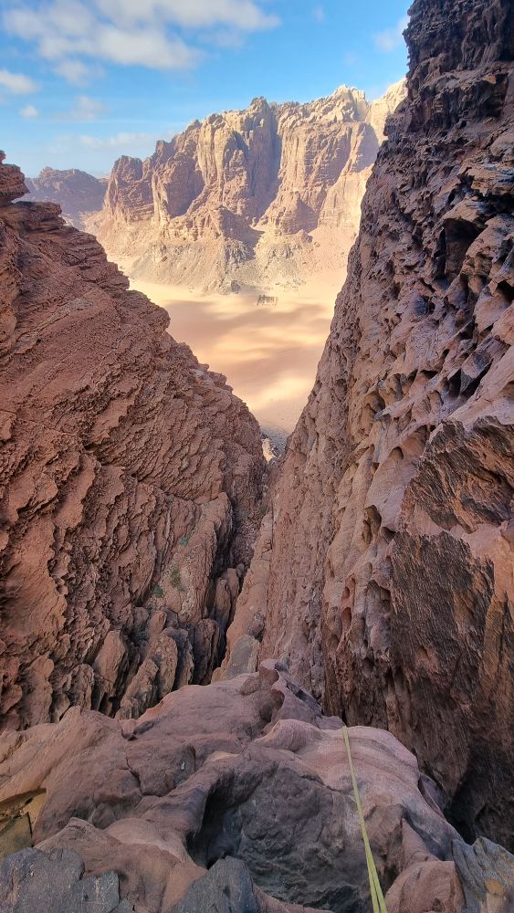
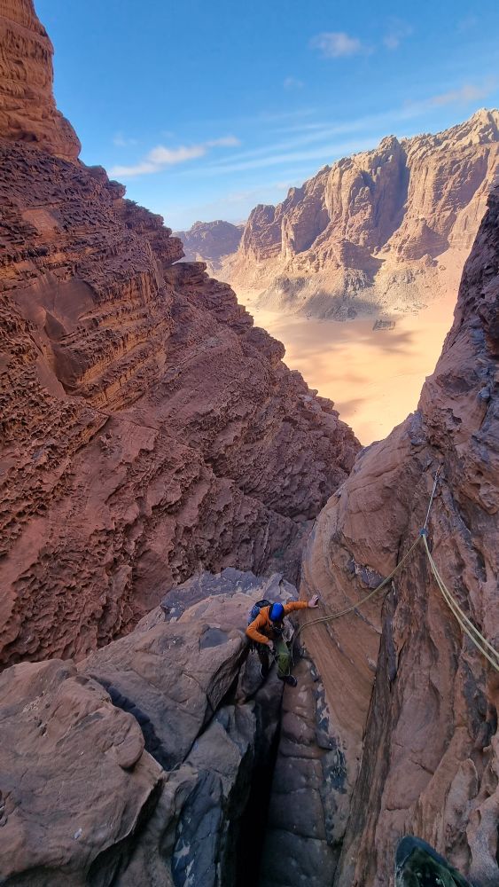
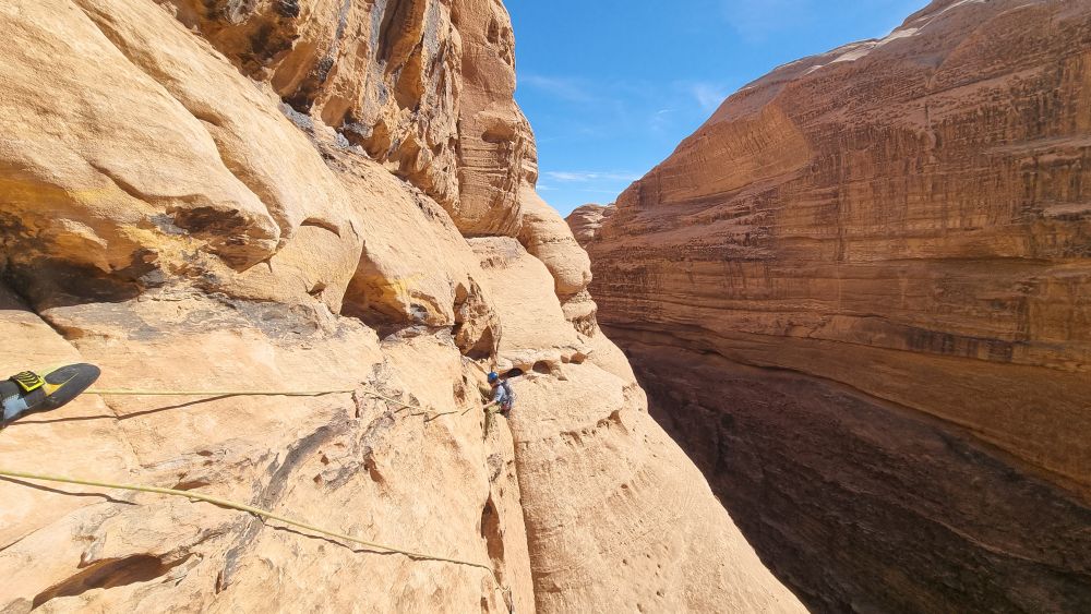
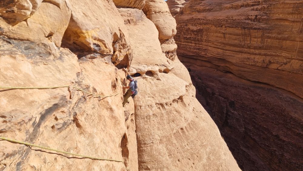
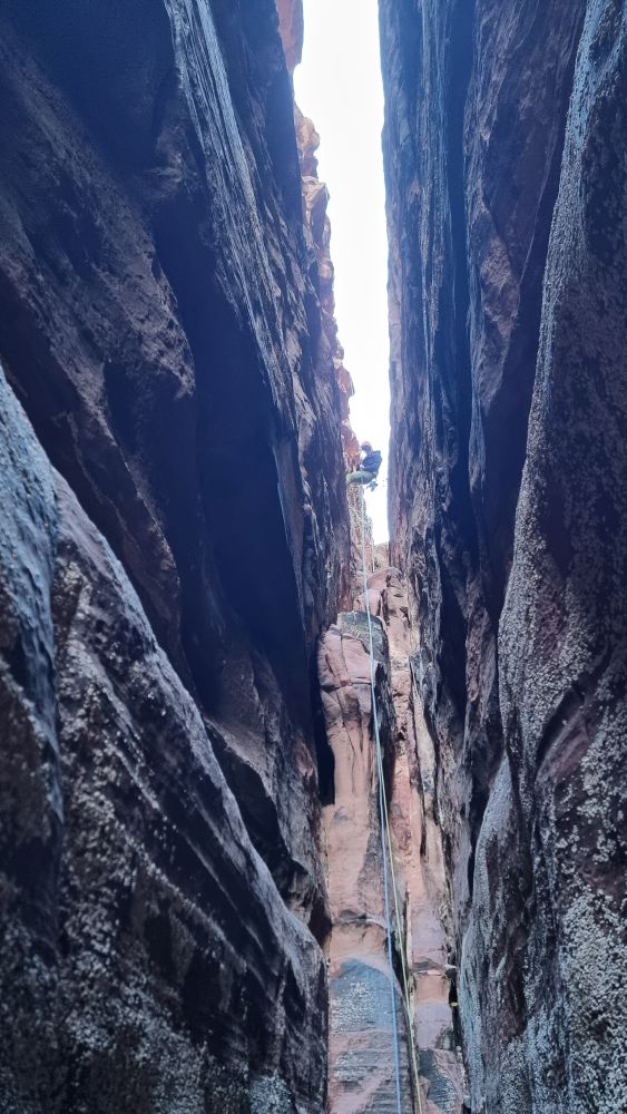
Result, we’re back on track! You are now entering the huge Siq which separates the North and South Towers, and you are about to burrow about a hundred metres almost horizontally into this cleft. The bolt is to protect the famous exposed traverse (not too bad at all – unlike the one further up!) and is soon followed by a situ thread.
Beyond that it’s an absolutely delightful ramble, with the occasional well-protected step…
… whilst gradually looming into view is the “Grand Diedre” / Great Corner.
We regroup at the foot of the corner…
This is a magnificent piece of climbing – a 50m 4* HVS the match of anything, anywhere, at the grade.
I ran out the first 30m of rope and then we simul-climbed the remainder to a sling belay (Note the rap point at the same level about 10m to the left – you’ll want to use that on the way down).
Here’s a GPS location immediately above this rap point.
29.561361° N 35.430004° E
Andy took over the lead to amble up another couple of rope lengths of wild but straightforward territory to another huge ledge system, passing a further rap point and adding another reflective marker.
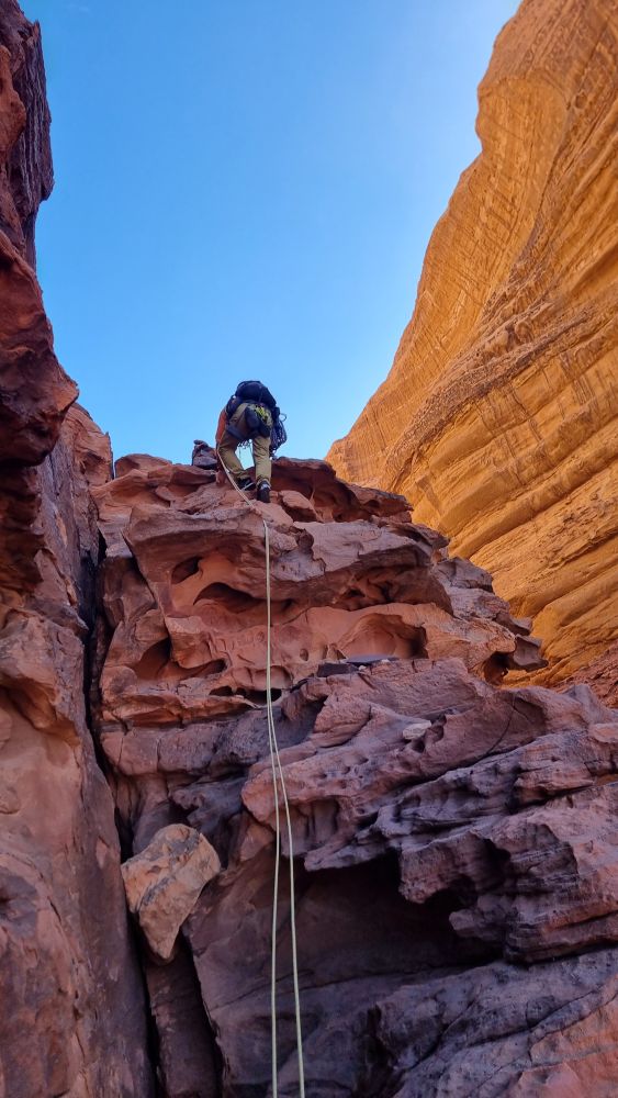
Now a walk of about 100m leftwards, beneath some steep and unfriendly looking walls, brings you to a couple of cairns and an obvious crack line of weakness.
Time for a sit down and a slurp of water.
Around about now I started to realise that Andy wasn’t quite his bright and bouncy self. He’s a generous chap, but it’s unlike him to handover all the leading duties on an outing. On questioning, he reluctantly reveals that he’s “not feeling great” but that we should crack on.
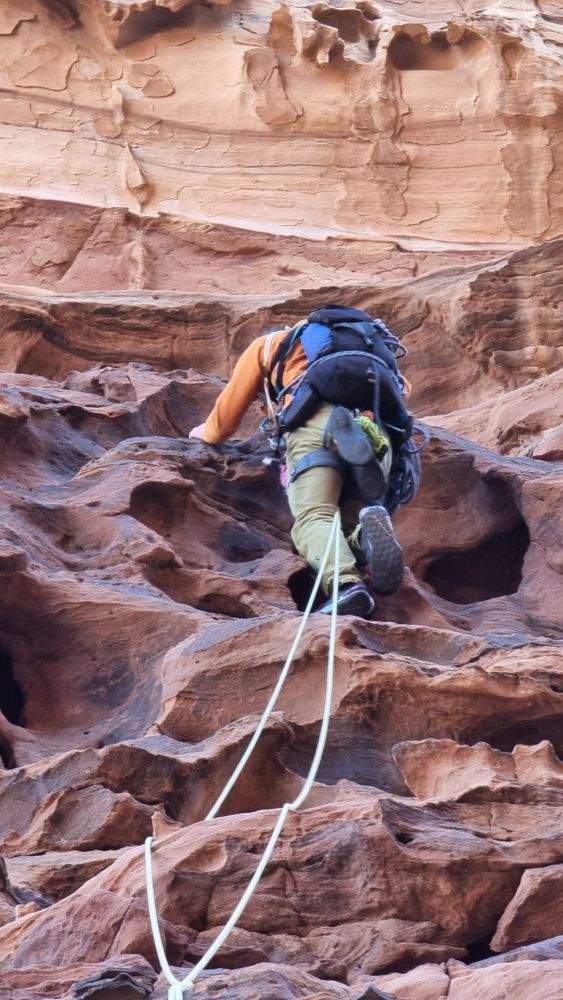
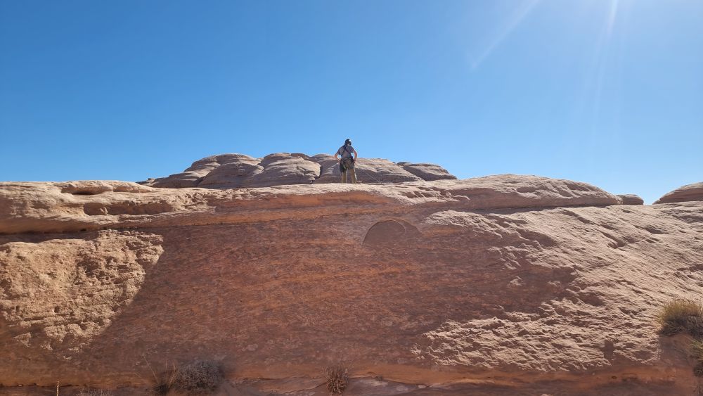
The geology has changed again, and we’re in smoother, whiter and sandier terrain. Another couple of pitches leads to a long sloping platform beneath a steep, pockety wall. This features as one of the photos in PdeL, with the mildly concerning caption: “The difficult to protect pitch 11 traverse”.
Towards the right hand end of the wall is a belay / rap point (take note for the descent) and you step onto the wall here and start heading horizontally leftwards (with the ledge dropping away from you). A couple of decent bits of gear followed by a situ thread had me scoffing: “hrumph – difficult to protect, eh?”, even showboating for a photo.
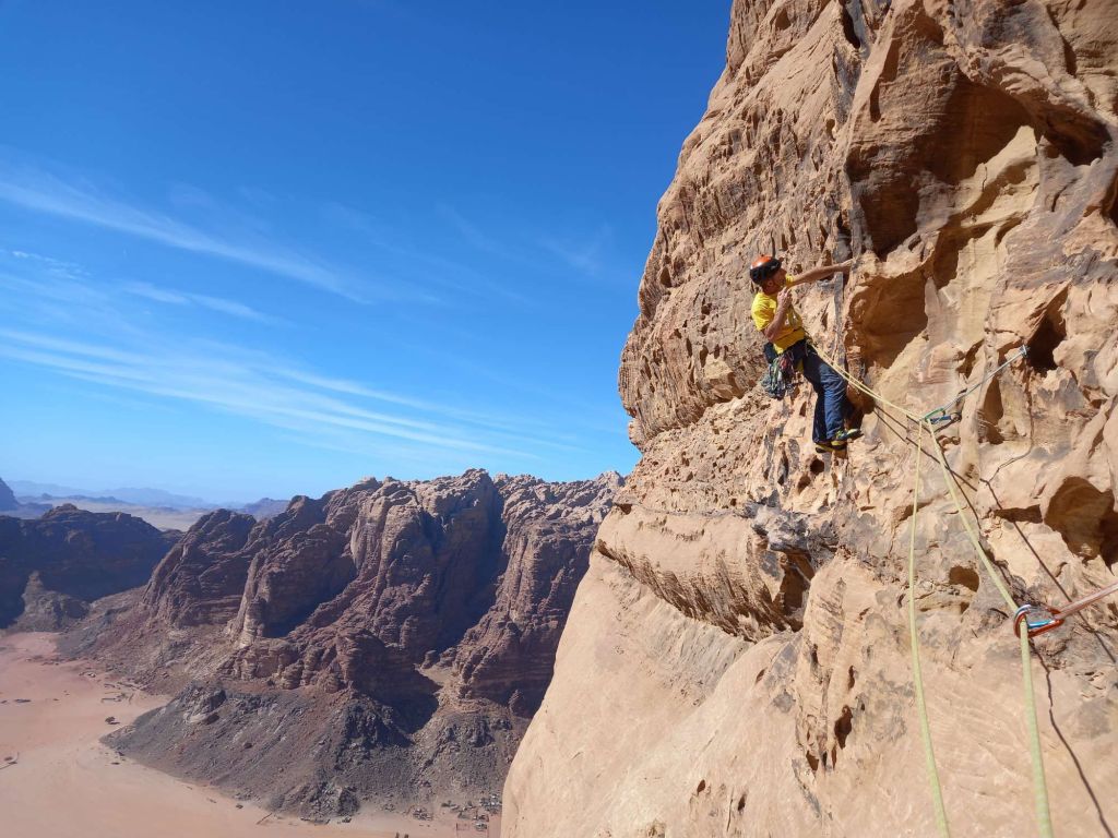
Dropping down a little to another pillar yields a further thread, but then the gear options run out and there’s a tricky sideways 5m or so before you can pull thankfully onto a sloping ledge. The original 5c grade for this pitch has been nudged up to 6a, which still doesn’t feel over-generous, and as for HVS, well you really are having a laugh. There’s a situ belay a few metres up a chimney crack at the left end of the ledge, but I felt it made more sense to belay earlier on cams to keep an eye on the second.
Andy swung briefly into the lead for what turned out to be another tough move (the last 6a one of the official P11 rather than the promised 4c), and strung the next two together into a subterranean world.
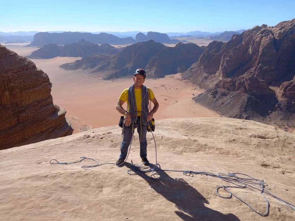
I took over again to simul-climb the final couple for a summit push, topping out to a flatish ledge, with no option other than a “sit down and be heavy” belay.
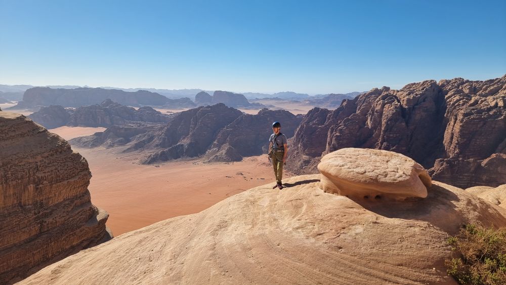
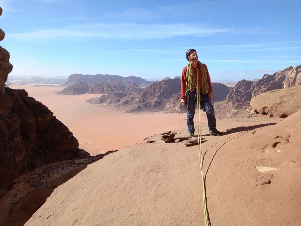
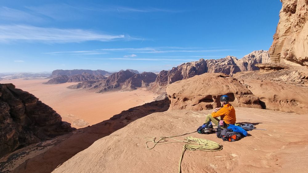
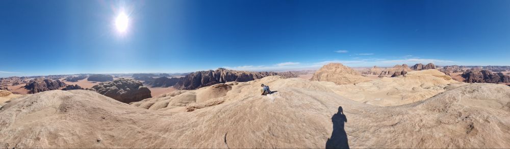
We’d discussed possible deadlines to “turn around and head down” with my opening bid of 2pm being raised to 3pm by Andy. We settled for 2.30pm and sure enough we topped out in around 5hrs, shortly after 2pm, leaving enough of a window for a jaunt to the summit. We coiled ropes and set off for a few hundred metres of sandstone padding in terrain reminiscent of Tuolomne (a huge contrast with the chaos of flutings and chimneys below).
Amazing 360 vistas over endless rocks and desert, and half a handshake to celebrate half a job done.
Time to head down…
The top rap point is quite a way to the right (looking down) of the top-out and hidden beneath a short, steep step, marked with a cairn.
GPS 29.562078° N 35.429392° E.
The original thread has thankfully been reinforced by a shiny glue-in bolt. On finding the cairn, Andy promptly announced he needed a lie down, and shortly after was creating another bright waypoint using the contents of his stomach 😦 Not a great state, given that we were now 500m above all difficulties, but even more reason not to hang about and spend the night.
There’s a further rap point about 30m down…
… from which a 60m rap gets you to the sloping ledge beneath the “hard to protect wall”. Another 60m from here brings the huge ledge and a reversal of the earlier walk. A bit of a scramble gets you to a rap point in the easy angled territory (complete with reflective tape) from which another gets you to the top of the corner and another to its foot. Meanwhile Andy has deposited another colourful “waypoint” and is soldiering on bravely despite being clearly under-the-weather.
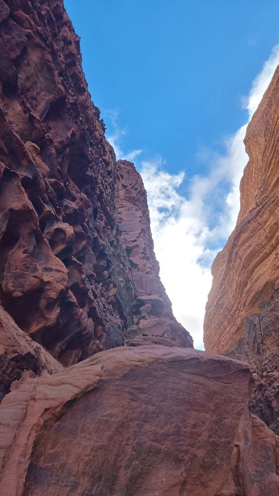
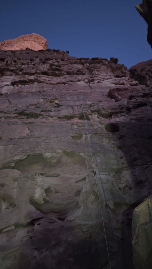
The descent now deviates from the way up, and you make a couple of long raps into the depths of the Siq. The further you go down, the narrower it gets, and it’s all pretty atmospheric by the time you hit the sandy floor. You can barely turn around!
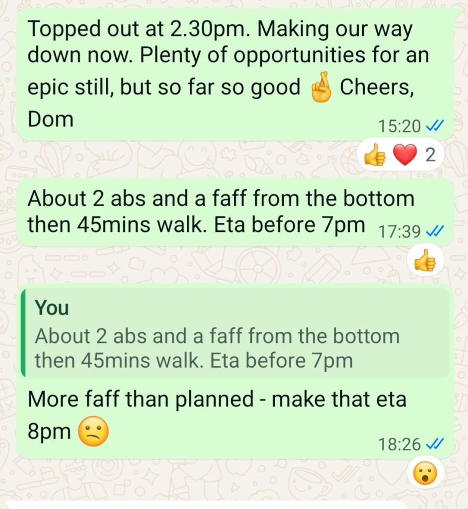
A sandy shuffle is followed by a further short rap off a jammed boulder and you are finally out of the depths and into the world of the largely horizontal for a while. Things are looking good – with careful rope management and a healthy dose of good fortune, the ropes have pulled smoothly on every occasion, it’s 5.30pm and we’ve got another hour of daylight, with only a couple of raps and a bit of faff followed by the 45mins walk back to base. I may have jinxed things with my WhatsApp to the group chat…
The topo indicates that a shelf is traversed from the end of the Siq and we scoured the wall for a line of cairns to identify which of the numerous shelves we should take, to no avail. A tempting rap point saw me exploring even further down, then retracing my steps from a vertiginous dead-end. In the end we plumped for the most likely candidate and traversed fairly easily out of the depths of the Siq and around onto the face. We then spent about half an hour looking for a “flat-topped pillar” and the penultimate rap point without success, then deciding to create our own and debating various less-than-ideal options – Headtorches on now. In the end we navigated to directly above the GPS coordinates of the lower rap point, found a suitable bollard to wrap some tat around, and set off into the unknown with the mournfull strains of the call to prayer echoing up from the village below. As I passed the halfway mark, my headtorch beam picked out a shiny square in the gloom below. Result, we’d absolutely nailed the final rap point to within a couple of metres!
Elation was soon replaced with frustration, followed by mild concern, as the knot pulled freely down but the trailing end of the rope snagged on one of the numerous gargoyles on the way down, about 15m above our heads. After trying the full playlist of flicking, yanking and twanging tricks, I reluctantly concluded I’d have to climb up to free it. Climbing up the rib, across the void from the jammed rope, I got level with the cluster-f#*k and managed a few deft cowboy rope manoeuvres, and to my joy the rope slithered down to Andy on the belay below. Now I just needed to join them both.
Tieing off a knob to give me some tenuous protection for the downclimb, I untied my rope to thread the tat and did one of the stupidest things I’ve ever done – I dropped the rope. Andy said he’d never heard me use “that word” before! Looking down, I was contemplating down-soloing the sketchy moves in the dark and in my approach shoes when I noticed that my figure of eight had lodged on a small ledge about 5m below – the only time a stuck rope has ever been good news. Without daring to breathe for fear of dislodging it, I looped a few slings together to protect me and reversed down to grab it. Phew! Redemption! Happy Days!
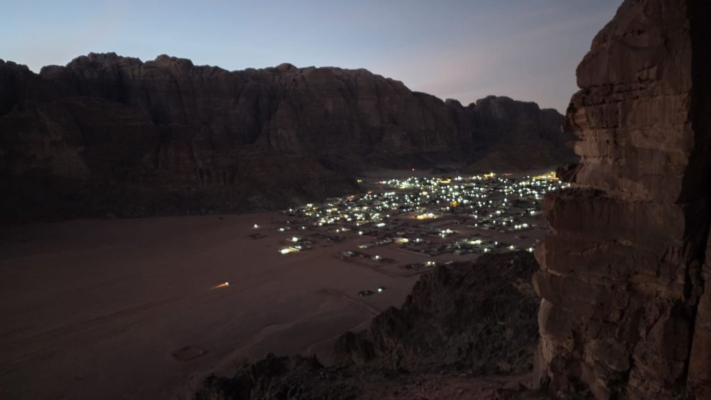
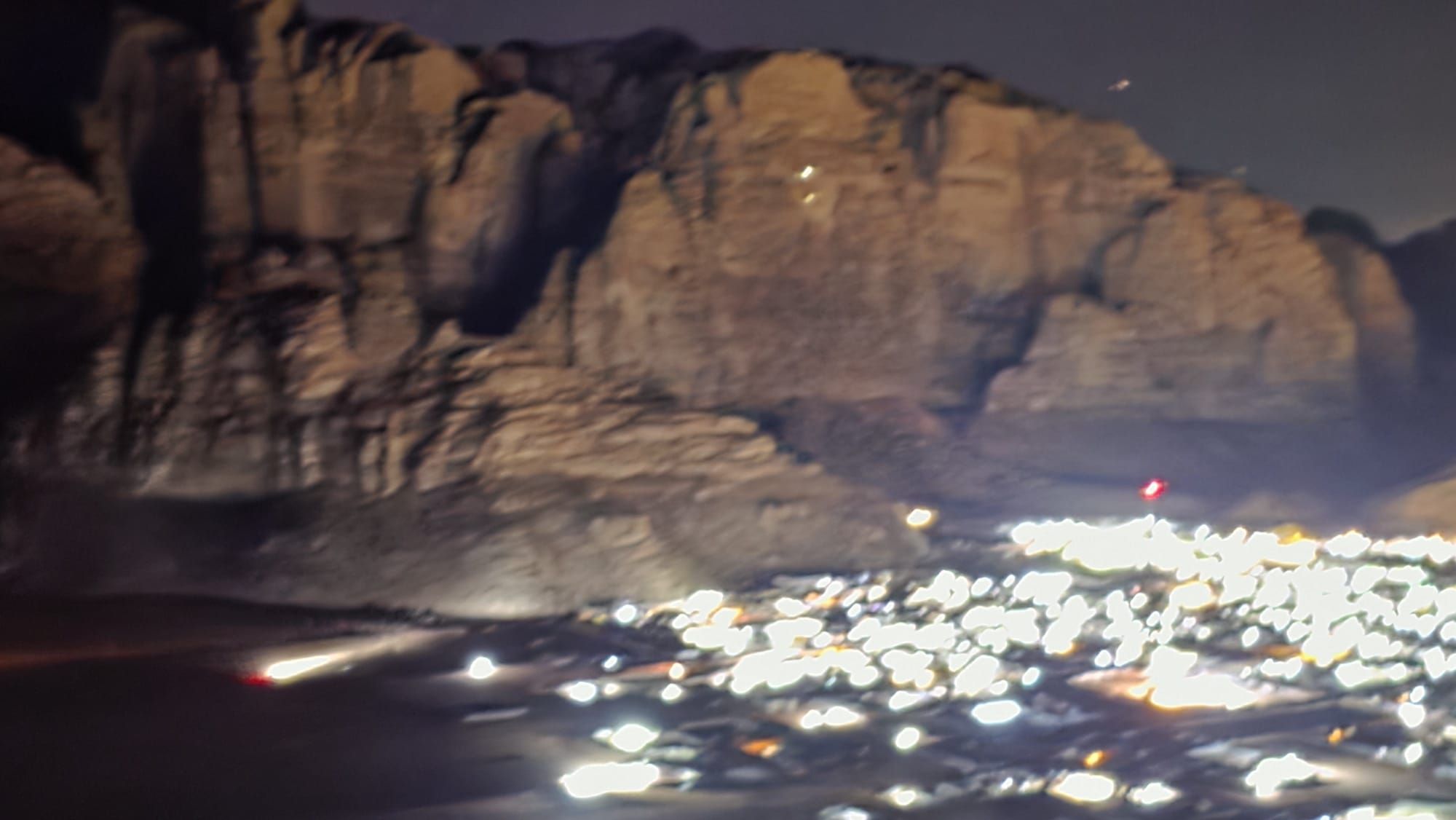
Meanwhile, Wadi Rum was lit up as brightly as Manchester…
… and the desert was criss-crossed with speeding 4×4 taxis ferrying tourists back from their “sunset experiences”.
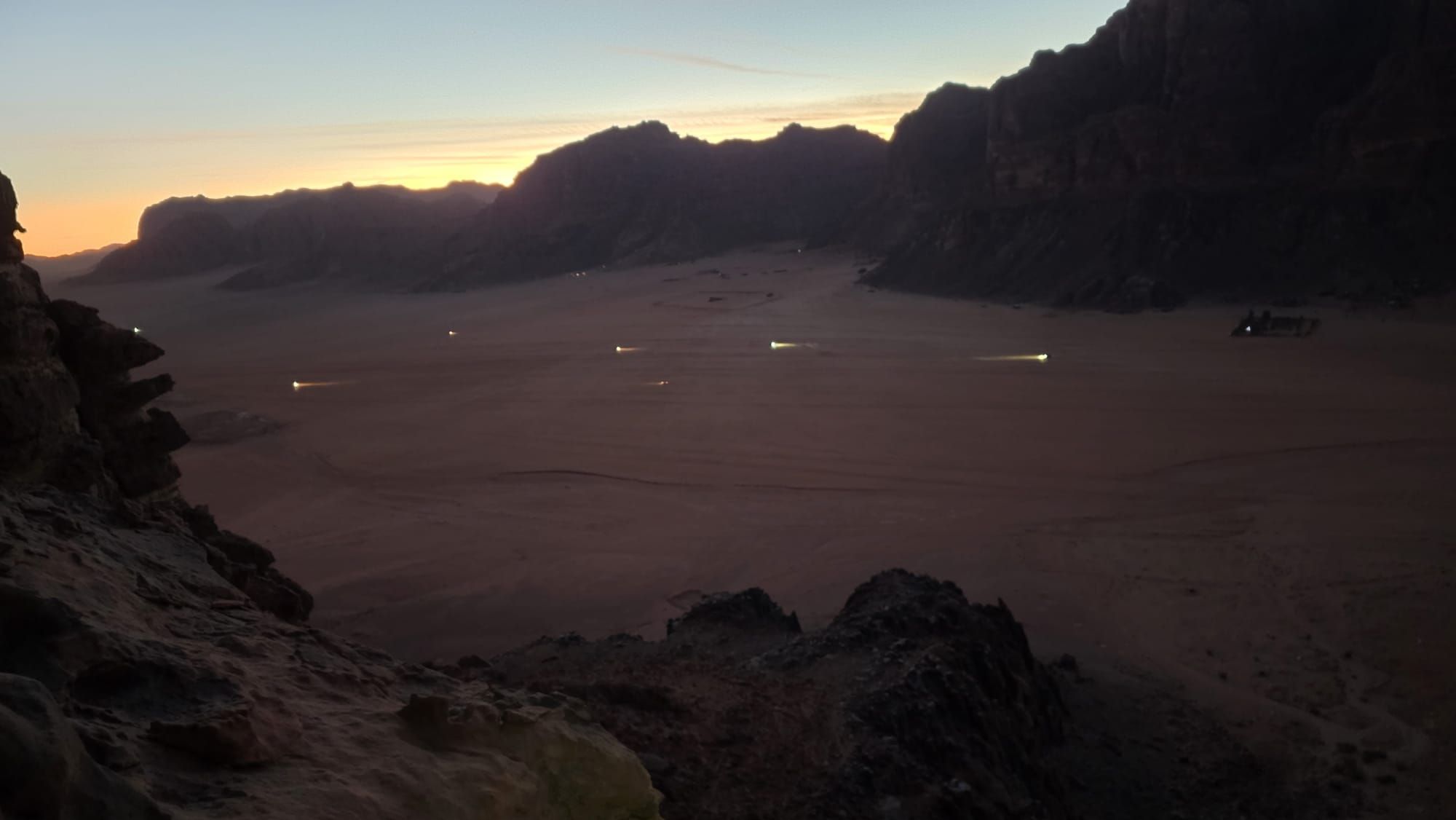
Looking across to the opposite side of the valley we could pick out the headtorches of a couple of other teams who’d be even later for supper.
After all the palaver, I made extra sure to maneuver the knot down over the edge of the ledge on the final rap for a nice smooth pull, as I eased back to tera firma. We allowed ourselves the second half of our handshake and I turned to pull the rope. It eased down, albeit with a lot of friction, and we were starting to contemplate the inevitable chicken and rice supper with some relish when the rope snagged. Aaargh! Much pulling, twanging and flicking failed to release it and we reluctantly concluded that this was a job best tackled in daylight. We were down safely, we were tired, and Andy especially could do with his pit. Time to head down.
We picked up a much better route down through the scree and as we approached the foot of the crag a headtorch shone up towards us. Surely our boys hadn’t come to our rescue – we were barely after our recently posted ETA? It turned out to be one of the local Bedouin climbing guides, Omar (Hamdan’s Uncle). He was there to pick up a team who’d been planning to descend Hiker’s Road after climbing Guerre Sainte on the other side. We assured him we hadn’t seen anyone and he kindly offered us a lift home. Result! We stumbled into the kitchen on the stroke of 8pm – not too shabby after all.
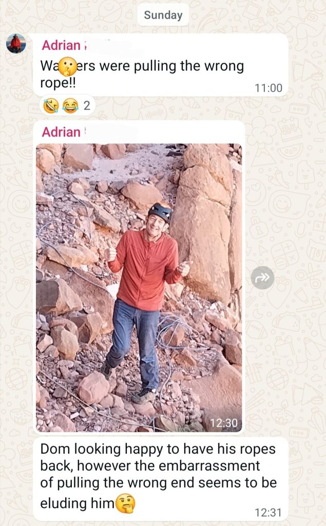
All that remained to fully salvage the day was the business of retrieving the ropes in the morning. With Andy out of action I needed some ropes and one or more accomplices, and was very grateful when Ade and Ian volunteered both, having decided not to climb that day. We even got a lift from Hamdan, so just had the 20mins schlep up the scree gully.
Our plan was for me to lead us up the first three pitches to the rap point and then for us all to head down, hopefully rectifying whatever had jammed the knot. I gave the rope an exploratory tug, just in case it had freed itself overnight by magic. No luck. Then I noticed that the two ends of the rope on the ground were similar lengths, and the fog of confusion started to evaporate. Surely I hadn’t been so stupid as to pull the wrong rope? Sure enough, I pulled yellow and just kept on pulling until the knot came into view, and soon after both ropes were lying on the floor. Muppet!
Ade, erudite as ever, summed up the situation with a WhatsApp report to the group…
All’s well that ends well, and we survived the experience and re-learned a few lessons into the bargain (the most fundamental being a reminder of how befuddling the combination of tiredness and darkness are, and to make allowances accordingly). What a route! What an adventure! Thank you Arnaud for the inspiration (and the sandbag!)
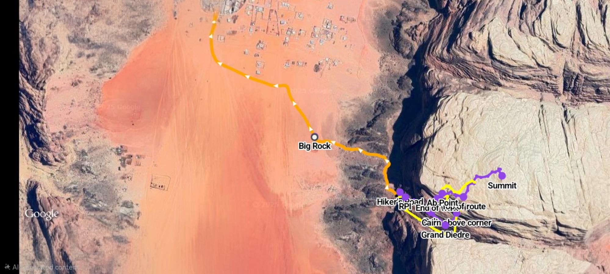
Here’s an overview of the approach:
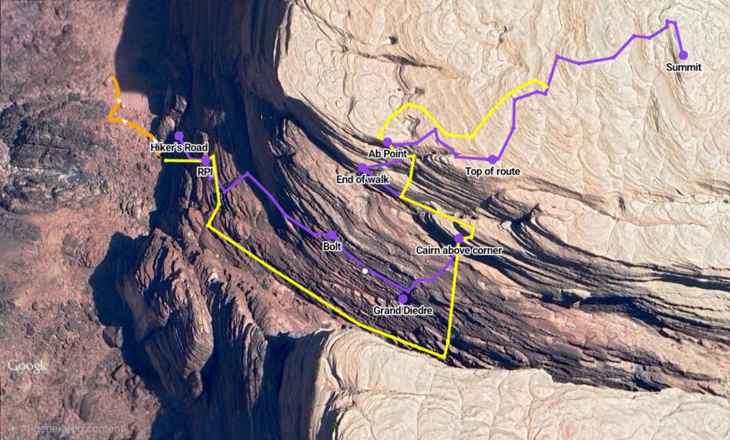
A rough plan view of the route:
- Orange – Approach
- Purple – Ascent
- Yellow – Descent
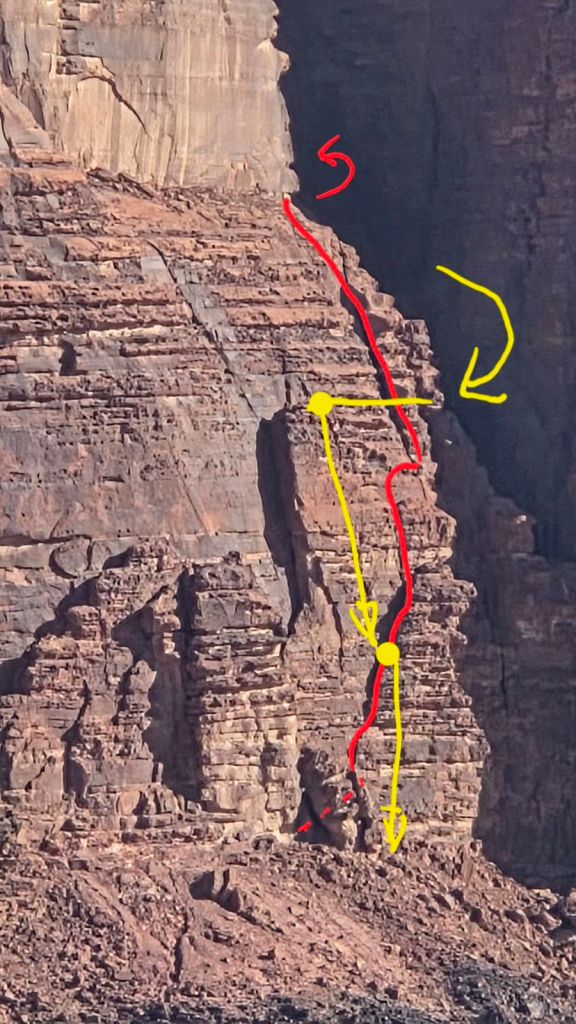
And an even more approximate topo of the first third of the route (before it disappears into the Siq
… and a guess at where we came down: